Please help the next visitor by writing a few lines about the beach, are there toilets? Is it shallow? Is there a jetty or maybe a kiosk?
Beaches close to Murrough Beach
Wicklow Harbour houses a calm bathing spot with a smooth, gravelly beach and nearby parking. In the summer, there is a floating platform available.
Silver Strand is a gently sloping sandy beach, occasionally rough due to its exposure. It is situated 1.2km north of the Wicklow Head SPA and Wicklow Reef SAC. The beach is divided at high tide and only accessible through the adjacent caravan parks.
Brittas Bay North Beach is a vast expanse of gently sloping sandy coastline that extends for an extended length. The beach's natural landscape consists of hilly sand dunes that harbor and promote the growth and preservation of two protected plant species. The beach terrain creates shallow water sills, causing gradual water depth decline, with sandbars commonly visible. Additionally, Brittas Bay North Beach is a suitable location for water sport activities comprising surfing, windsurfing, canoeing, and snorkeling.
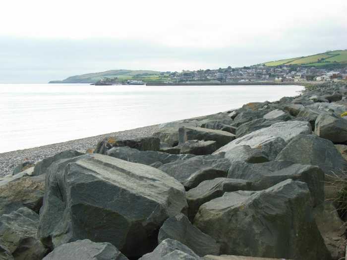
Kilcoole Beach can be accessed by Sea Road to the east of Kilcoole. This expansive shoreline is composed of gravel.
Brittas Bay South Beach is a sandy beach that gently slopes and is backed by a hilly sand dune area. It is part of the Buckroney-Brittas Dunes and Fen Special Area of Conservation, which has rare plant species. Popular activities at the beach include surfing, windsurfing, canoeing, and snorkelling.
Greystones South Beach is a steep shingle beach, with sudden declines into the water and bordered by a railway line.
A cove with a shingle beach can be found south of Greystones Marina, set amidst a rocky foreshore. Access can be gained at your own risk by taking the sloped path located at the southern end of the beach.
Arklow South Beach in Arklow Town is a sandy beach lined with rocks.
Bray South Beach is a shingle beach with clear waters and some seaweed growth. It is sheltered by Bray headland to the south, which is part of the Special Conservation Area. The area is rich in local flora and fauna, and visitors can observe cormorants, porpoises, and dolphins.
Just south of Bray Harbour lies a sheltered beach that can be accessed from the car park on the north end of Bray Seafront. The beach features a mix of sand and gravel.