Please help the next visitor by writing a few lines about the beach, are there toilets? Is it shallow? Is there a jetty or maybe a kiosk?
Beaches close to Grange
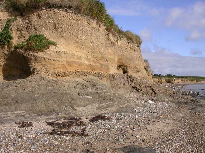
Baginbun is a sandy beach situated on the Hook Peninsula. It faces east and is located 2km south of Fethard village. During low tide, rocks can be seen on the mostly gently sloping beach.
Booley Bay beach, situated along the Duncannon to Hook Head road, offers a tranquil and secluded experience with its golden sand. Car parking is available on the side of the access laneway.
Duncannon beach boasts a peaceful atmosphere and a relatively gentle slope of firm sand. The sand dunes, stretching between 5m and 100m to the north, lack significant vegetation except for the rare Wild Sage (Salvia verbenaca) listed in the Irish Red Data Book. A popular sand sculpting festival occurs in the summer, complemented by attractions including a maritime museum, cockleshell art center, artist studios, café, and craft shop. The beach accommodates limited watersports, such as surfing, windsurfing, and canoeing. Enjoy roughly 1.0 km of pristine bathing area encompassing approximately 0.2 km².
Cullenstown beach faces south and is a sandy beach located on the western edge of the River Muck's entrance to the sea.
Woodstown Beach is a lengthy and sandy beach bordered by private wooded areas. It is tidal and stretches up to one kilometer during low tide, revealing a vast and level beach.
Counsellors Strand is a stunning sandy beach nestled within a steep cove featuring striking red sandstone cliffs and unique geological formations, including visible folding. The beach is home to a diverse range of sea birds, including kittiwakes that nest along the cliffs. Above the beach is a grassy area ideal for picnics and taking in the stunning views. The designated swimming area stretches 100 metres in length and 75 metres in width during low tide, offering opportunities for swimming, bodyboarding and kayaking. Adventurous visitors can explore a range of on and off-water activities at the nearby adventure centre located at the harbour, such as rock climbing.
Dunmore Strand boasts a serene sandy beach surrounded by a steep-sided cove. The beach enjoys ample sheltering and a mild incline. Seabirds flourish among the cliffs, with kittiwakes hatching on their faces. The beach lends itself to various activities, such as swimming, bodyboarding, and kayaking. The official bathing area spans about 100m x 75m at low tide. Additionally, tourists can find an adventure hub at the nearby harbor that offers a wide selection of water sports and rock-climbing.
Kilmore Quay village has a small southerly-facing beach located just east of the fishing harbor within the Saltee Islands SAC.
Ballyhealy beach is a shallow sandy beach located towards the east of Kilmore Quay in Co. Wexford.
Tramore is a 3 km long sandy beach with a gentle slope down to the water's edge. It boasts of rock pools that can be explored during low tide, teeming with diverse marine wildlife and plant species. On the west side of the beach, there is a rare lagoon-type salt marsh in Ireland and sand dunes. These exceptional features make the area a Special Area of Conservation (SAC) and a Special Protection Area (SPA). Visitors can participate in numerous activities such as swimming, surfing, kite surfing, and kayaking.