Curracloe

Rating: 0.0/5 (0 votes)

  • Water temp(satellite):
  • 14.4°C
  • 2024-10-14

Curracloe is a beach in the county of Wexford. Toilets and parking lot near the beach. Dogs are not allowed on the beach. Guests with impairments can access the beach. Beach wheelchair is available. Available May to October inclusive. Contact The Surf Shack 053 9137679 / 087 7519194
Curracloe is a serene, rural beach with fine, soft, wind-blown sand and gentle slopes. It features wooden walkways that sometimes get covered by sand. Its sand dunes extend between 100m to 300m westward, while also being part of The Raven Special Protection Area that's crucial for bird conservation and is included in the Wexford Slobs and Harbour complex. It's a popular fishing spot and is sometimes used by a small number of surfers, windsurfers, and canoeists. The bathing area extends about 1 km in length and covers 0.2km².
Activities;Curracloe beach is also a popular fishing spot. Spring and autumn nights are the best time to catch bass, smoothhound, flounder, codling, whiting and dogfish. The beach is also used by a limited number of surfers, windsurfers and canoeists. Facilities;Public car parking is provided at the beach with approximately 500 parking spaces available, the majority at White Gap. There are 4 and 2 disabled spaces at White Gap and Ballinesker respectively. Access to the beach is from car parks to wooden sleeper walkways to White Gap/Ballinesker/Culletons Gap beaches. Culletons Gap has steps at the end of the Wooden walkway which are sometimes buried. The boardwalk at Ballinesker is best for wheelchairs and nearly flat. At Culletons gap it is very steep. White Gap is less steep but can be buried in sand at the beach entrance. Soft sand makes it challenging once you depart the boardwalk. Male, Female and disabled toilet available at White Gap, Male and Female only at Ballinesker. Opened Bank holiday weekends October to May. All 7 days/week May – October Opening hours 8am - 9pm. Universal key is required to gain access to the accessible toilets. Life guards are on duty on site at White Gap during summer months. There is a children’s playground beside Hotel CurracloeA nature trail runs through the beach dunes and continues for 5 km to Raven Point, passing through the beautiful peninsula which constitutes Raven Nature Reserve.
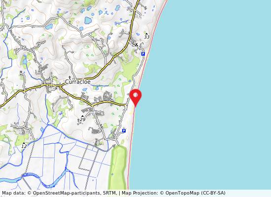
Location;The beach is part of a continuous stretch of wide sandy beach from Raven Point to Ballyconnigar near Blackwater. There are very few buildings located near the beach as a large part of the area surrounding the beach is an SAC made up of an Internationally important dune system stretching along the coastline backing the beach itself. Curracloe beach has three main entrances known locally as Ballinesker, White Gap and Culletons Gap running north to south, White Gap being the largest. Culletons Gap is bordered by the Raven Nature Reserve and forestry. A safe rural fine-sand beach, Curracloe has had Blue Flag status since 2004. The best access is via the R742 and Curracloe VillageThe movie, “Saving Private Ryan”, was filmed here. Extent;The bathing area is approximately 1.0 km long. The bathing water is approximately 0.2 km2in area.
;A safe rural peaceful fine-sand beach, Curracloe has had Blue Flag status since 2004. The sand type is soft and wind blown and often covers the wooden walkways. Deposition offshore into a series of sand-banks offers protection to the beach.

Weather forecast
Curracloe on the map
Report water temp:

Photos near Curracloe

Do you have a nice picture from Curracloe?
By uploading an image, you certify that you own the image and that it may be displayed on beachguideireland.com

Reviews of Curracloe

No reviews of Curracloe yet...
Please help the next visitor by writing a few lines about the beach, are there toilets? Is it shallow? Is there a jetty or maybe a kiosk?
What do you think of the beach?

Beaches close to Curracloe

Culletons Gap ⟼ 1 km away
Culleton's Gap is situated one mile from Curracloe Co Wexford, forming part of the sandy Curracloe stretch overlooking Wexford Bay and the Irish Sea towards the east. It shares borders with Raven Nature Reserve, the North Slob Land and Wild Fowl Reserve towards the west.
Ballinesker ⟼ 1.3 km away
Ballinesker is a serene rural beach with fine soft sand and a gentle slope. Wooden walkways may be covered with sand due to the wind. The beach is protected by sand-banks and sand dunes extend up to 70m behind the beach. However, there is no significant vegetation growth in the waters near the beach. It's popular for fishing and used by few surfers, windsurfers, and canoeists. The bathing area spans around 1 km with an area of 0.2 km².
Rosslare Strand ⟼ 12.9 km away
Rosslare Strand is an urban beach with fine, soft, windblown sand and a gentle slope. The sand dunes to the west are narrow and vegetation is scarce in the waters. The Wexford Wildfowl Reserve is located nearby, offering stunning views of the southeast coast of Ireland. The beach is a popular fishing spot, as well as a limited area for surfing, windsurfing, and canoeing. The bathing area spans 0.5 km and covers 0.1 km².
Morriscastle ⟼ 16.3 km away
Morriscastle beach is a serene and rural sandy beach with soft, wind-blown sand and a gentle slope. Behind the beach, the sand dunes stretch up to 100m westward. The bathing area, which spans 1.0 km in length and 0.2km² in area, falls within the conservation region of Kilmuckridge-Tinaberna sand hills, which supports unique dune habitats and thus designates Morriscastle beach as an SAC. There is no significant vegetation in the water near the beach.
St Helens Bay ⟼ 17.6 km away
St. Helens Bay Beach, located south of Rosslare Euro Port, is a tranquil and sheltered beach. There is convenient car parking available directly beside the beach.
Old Bawn ⟼ 20.7 km away
Old Bawn Beach is a 3km long sandy coastline located in County Wexford, 5km southeast of Ballygarrett village. It is part of the Cahore Polders and Dunes National Heritage Area and faces east towards the Irish Sea, with a line of sand dunes on its western border.
Carne ⟼ 21 km away
Carne is a sandy beach located near Carne pier, facing east towards the Irish Sea with a dune system situated to its west.
Cahore ⟼ 21.9 km away
Located adjacent to the rural village of Cahore, in Co. Wexford, Cahore Beach is a pebbled beach stretching for approximately 500m. It offers stunning views of the Irish Sea and is complemented by a pier and a car park for visitors' convenience.
Ballyhealy ⟼ 24.9 km away
Ballyhealy beach is a shallow sandy beach located towards the east of Kilmore Quay in Co. Wexford.
Kilmore Quay Small Beach ⟼ 28.3 km away
Kilmore Quay village has a small southerly-facing beach located just east of the fishing harbor within the Saltee Islands SAC.
Beach Guide Ireland Source for water samples and information: the Environmental Protection Agency, users of the site and local municipalities.
Source for weather data: Met Éireann© (CC BY 4.0) Disclaimer: Met Éireann does not accept any liability whatsoever for any error or omission in the data, their availability, or for any loss or damage arising from their use.
Source of satellite-read water temperature: Copernicus Sentinel satellite data from the European Space Agency.