Mary and Angus Hogg 
Photo: Mary and Angus Hogg  CC BY-SA 2.0

Carne

Rating: 0.0/5 (0 votes)

  • Water temp(satellite):
  • 14.4°C
  • 2024-10-14

Carne is a beach in Wexford. Life guard is present at bathing season. There are toilets and a parking lot near the beach. Dogs must be kept on a leash at all times. People with disabilities can access the beach. Beach wheelchair is available. Available June to August inclusive. Located at public car park. Key from Carne Beach Caravan Park 053-9131131.
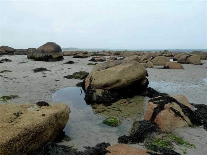
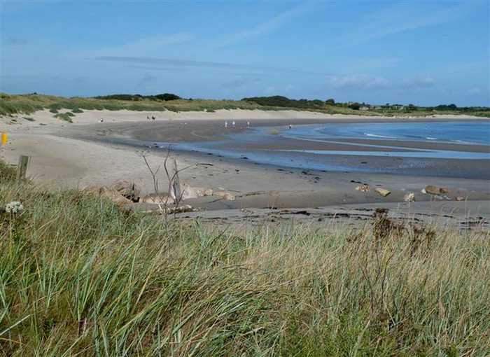
Carne is a sandy beach located near Carne pier, facing east towards the Irish Sea with a dune system situated to its west.
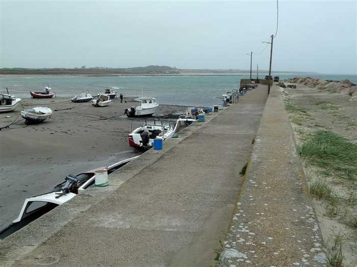
Facilities and ActivitiesThere is car parking available at Carne. Male, female and disabled toilets are available. They are open 24/7 all year round. Universal key is required for access to the accesible toilets. Lifeguards are on duty on site during the summer months. There is a large caravan park with associated facilities adjacent to the beach. The pier nearby is used by small commercial fishing boats during summer months.
LocationThe beach is located adjacent to Carne pier at the south east of Co. Wexford between Carnsore Point and Greenore Point. The beach is easterly facing towards the Irish Sea and is backed by a dune system to the west. ExtentThe bathing area is approximately 250 metres long and approximately 0.05 km² in area.
;A firm-sand beach.

Weather forecast
Carne on the map
Report water temp:

Photos near Carne

Mary and Angus Hogg 
Photo: Mary and Angus Hogg  CC BY-SA 2.0
Mary and Angus Hogg 
Photo: Mary and Angus Hogg  CC BY-SA 2.0
Mary and Angus Hogg 
Photo: Mary and Angus Hogg  CC BY-SA 2.0
Do you have a nice picture from Carne?
By uploading an image, you certify that you own the image and that it may be displayed on beachguideireland.com

Reviews of Carne

No reviews of Carne yet...
Please help the next visitor by writing a few lines about the beach, are there toilets? Is it shallow? Is there a jetty or maybe a kiosk?
What do you think of the beach?

Beaches close to Carne

St Helens Bay ⟼ 4 km away
St. Helens Bay Beach, located south of Rosslare Euro Port, is a tranquil and sheltered beach. There is convenient car parking available directly beside the beach.
Rosslare Strand ⟼ 8.5 km away
Rosslare Strand is an urban beach with fine, soft, windblown sand and a gentle slope. The sand dunes to the west are narrow and vegetation is scarce in the waters. The Wexford Wildfowl Reserve is located nearby, offering stunning views of the southeast coast of Ireland. The beach is a popular fishing spot, as well as a limited area for surfing, windsurfing, and canoeing. The bathing area spans 0.5 km and covers 0.1 km².
Ballyhealy ⟼ 12 km away
Ballyhealy beach is a shallow sandy beach located towards the east of Kilmore Quay in Co. Wexford.
Kilmore Quay Small Beach ⟼ 16.5 km away
Kilmore Quay village has a small southerly-facing beach located just east of the fishing harbor within the Saltee Islands SAC.
Culletons Gap ⟼ 20 km away
Culleton's Gap is situated one mile from Curracloe Co Wexford, forming part of the sandy Curracloe stretch overlooking Wexford Bay and the Irish Sea towards the east. It shares borders with Raven Nature Reserve, the North Slob Land and Wild Fowl Reserve towards the west.
Curracloe ⟼ 21 km away
Curracloe is a serene, rural beach with fine, soft, wind-blown sand and gentle slopes. It features wooden walkways that sometimes get covered by sand. Its sand dunes extend between 100m to 300m westward, while also being part of The Raven Special Protection Area that's crucial for bird conservation and is included in the Wexford Slobs and Harbour complex. It's a popular fishing spot and is sometimes used by a small number of surfers, windsurfers, and canoeists. The bathing area extends about 1 km in length and covers 0.2km².
Ballinesker ⟼ 22.2 km away
Ballinesker is a serene rural beach with fine soft sand and a gentle slope. Wooden walkways may be covered with sand due to the wind. The beach is protected by sand-banks and sand dunes extend up to 70m behind the beach. However, there is no significant vegetation growth in the waters near the beach. It's popular for fishing and used by few surfers, windsurfers, and canoeists. The bathing area spans around 1 km with an area of 0.2 km².
Cullenstown ⟼ 25.4 km away
Cullenstown beach faces south and is a sandy beach located on the western edge of the River Muck's entrance to the sea.
Grange ⟼ 32.7 km away
Grange is a remote beach near Fethard on Sea located on the Hook Head peninsula. Parking is available on the roadside.
Baginbun ⟼ 32.8 km away
Baginbun is a sandy beach situated on the Hook Peninsula. It faces east and is located 2km south of Fethard village. During low tide, rocks can be seen on the mostly gently sloping beach.
Beach Guide Ireland Source for water samples and information: the Environmental Protection Agency, users of the site and local municipalities.
Source for weather data: Met Éireann© (CC BY 4.0) Disclaimer: Met Éireann does not accept any liability whatsoever for any error or omission in the data, their availability, or for any loss or damage arising from their use.
Source of satellite-read water temperature: Copernicus Sentinel satellite data from the European Space Agency.