Please help the next visitor by writing a few lines about the beach, are there toilets? Is it shallow? Is there a jetty or maybe a kiosk?
Beaches close to Goat Island
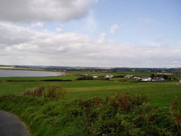
Whiting Bay is a 3.5 km sandy bay located west of Ardmore village.
Ardmore is a gently sloped sandy beach, flanked by two special conservation areas: Helvick Head and Youghal harbour. This region supports diverse wildlife. The beach offers activities like swimming, surfing, body-boarding and kayaking. While the beach is 1 km long, the designated 500m long and 100m wide bathing area is perfect for low tide fun.
Curragh Beach is a safe sandy beach located 2km North-East of Ardmore and 12 miles from Dungarvan. Its coastline offers a picturesque view for miles.
Ballyquin Beach, situated around 4km northeast of Ardmore in Co Waterford, is a remote beach with a considerable stretch of smooth sand. However, due to its open surroundings, it is advisable to carry a windbreak during windy days.
Youghal Front Strand is a sandy beach with a concrete promenade area, offering surfing, windsurfing, canoeing, and angling activities. Nearby is the proposed NHA, Ballyvergan Marsh NHA (Site Code 000078).
Laycastle Beach is a soft, sandy area with a small stretch of marsh and dunes, forming part of Ballyvergan Marsh (Site Code 000078) to the west. Popular activities here include surfing, windsurfing, canoeing, and angling.
Redbarn beach is a north-facing, gently sloping shore with a mix of sand and pebble particles. It is part of a 5km long stretch of sandy coastline that is typically subject to rough weather and waves. The beach's surroundings consist of sand dunes, farmland to the northwest, Ballyvergan Marsh, a proposed Natural Heritage Area, to the north, and Ballymacoda, including Clonpriest and Pillmore, a proposed NHA and Special Area of Conservation to the south. Although Redbarn beach is not heavily trafficked, it is used by anglers, walkers, surfers, and windsurfers.
Ring Beach is a protected sandy beach, situated approximately 3.5 km from Ballymacoda in Co Cork. It is designated as a Special Protection Area and Special Area of Conservation. The beach faces Ballymacoda Bay and Pillmor, and no bins are provided to adhere to leave no trace principles. Visitors are encouraged to take away any waste they produce.
Garryvoe beach is a gently sloping, sandy/pebble beach on a long stretch of coast. It faces south-east but is vulnerable to rough weather and seas. Sand dunes lie to the west. The beach sits in the proposed Natural Heritage Area and the Special Protection Area within Ballycotton Bay. Visitors enjoy anglers, walkers, surfers, and windsurfers.
Ardnahinch Beach is situated near Shanagarry in Co Cork, offering stunning views of Ballycotton and the Island lighthouse. At low tide, the beach is expansive, but it becomes a narrow strip of sand during high tide. The beach is a part of an SPA and is a noteworthy location for bird watching. As per 'leave no trace principles,' bins are unavailable.