Please help the next visitor by writing a few lines about the beach, are there toilets? Is it shallow? Is there a jetty or maybe a kiosk?
Beaches close to Mornington
Laytown/Bettystown is a stunning beach with fine sand and sand dunes that is home to a links golf course. The area to the north is a Special Area of Conservation (SAC site code 001957), known as the Boyne Coast and Estuary, while the south is a designated Special Protected Area (SPA site code 004158), specifically the River Nanny Estuary and Shore. Visitors can partake in a variety of beach activities, including sandsculpting and kitesurfing, and Laytown/Bettystown has also hosted the National Sand Sculpting and Sandcastle Competition. An annual event, the Laytown Strand Race, takes place on the beach, which has a bathing area approximately 1.5 km long and 0.6 km2 in size.
Seapoint Beach is a spacious expanse of sand and shingle, with its bathing water situated adjacent to sand dunes. Its designated 1270m long bathing area is separated by the Termonfeckin River. Additionally, to the south, there are some small rocky sections and sand bars.
Clogherhead beach is a spacious and gently sloping sandy beach located mainly to the east, with rock and dune formations to the north. Two small rip currents exist at the beach's northern end, while the area features sand dunes and rocks, as well as a variety of marine life, such as crabs, jellyfish, sea beet, and limpets. To preserve the beach, Foreshore Byelaws 2003 prohibit motorized vehicles from entering the area. During peak season, an estimated 200 visitors visits the beach daily, which has a gently sloping bating area spreading over a length of roughly 1430 meters.
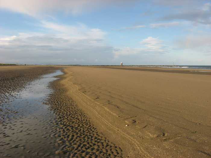
The beach is predominantly composed of sand, with a minor section of rocky formations that are interspersed with sand dunes. These dunes, in turn, provide a thriving habitat for a diversity of plant species, contributing to the ecological value of the area. Additionally, a range of fauna, such as crabs and seaweed, are present on the site. It is important to note that the contiguous conservation-designated zones in close proximity to the beach are Clogherhead SAC and Dunany Point NHA. The beach spans a length of approximately 2300 meters, and the area designated for swimming gradually descends into the ocean.
Balbriggan Front Beach is a compact sandy beach that is adjacent to a functioning harbor.
Skerries South Beach is a lengthy sandy shore that gradually slopes towards the sea. The beach's northern edge is demarcated by the Red Island headland rocks.
Loughshinny Beach is a small, sheltered sandy cove that gently slopes down. It is located in close proximity to Loughshinny harbour, which is a bustling fishing hub situated to the east of the beach.
Rush North Beach is a sandy beach with a large dune area at the back, gently sloping and bordered by Rush Harbour on the South and a rocky headland on the North.
South Beach Rush is a sandy beach with a sloping landscape and a large sandy dune area in the rear. The beach is partially sheltered by a rocky headland to the North.
Portrane Brook Beach is a sandy beach on the seaward side of the Portrane Peninsula, with a gradual slope. It extends to the north, becoming Burrow Beach where sandy dunes can be found. However, strong currents are present at the northern end of the beach.