Please help the next visitor by writing a few lines about the beach, are there toilets? Is it shallow? Is there a jetty or maybe a kiosk?
Beaches close to Mulranny Beach
Old Head Beach is a sheltered and sandy beach, backed by rocky cliffs and surrounded by Old Head woodland. The beach is located next to the Old Head SAC/pNHA, which is an extreme development of Atlantic oakwood habitat directly adjacent to the coast. Pilgrimages take place at Croagh Patrick, which is nearby. Old Head Beach offers various activities such as swimming, surfing, water skiing, jet skiing, scuba-diving/snorkelling and fishing. The bathing water area is approximately 0.3km2 and the water depth varies from 0.5m to 5.0m depending on tides.
Carrowmore Beach is a beautiful sandy area that includes sandy dune towards the east. However, swimming is restricted in the eastern part of the beach, near Bunowen River and Tulin Beach. Carrowmore Strand is a part of the proposed National Heritage Area and offers activities like surfing, windsurfing, fishing, and more. The bathing area is around 0.3km2 and the water depth varies between 0.5m to 5.0m with tides.
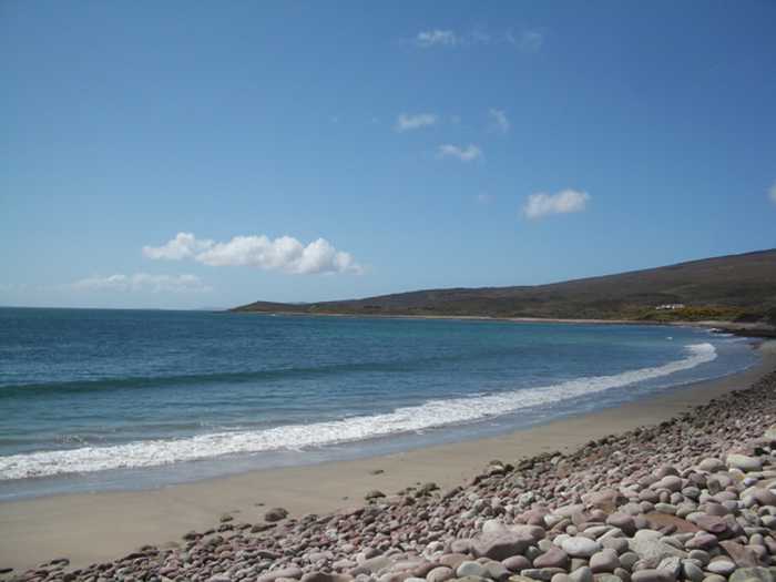
Bertra Beach is a sandy dune area, enclosed by caged stone in the bathing zone. The beach is exposed, with the likelihood of rip tides and strong currents. The sand dunes are a mixture of embryonic and marram dunes, both of which are listed in Annex I of the EU Habitats Directive. In the last decade, restoration work has successfully reduced the erosion extent. Bertra Beach is part of the Clew Bay Complex (SAC & SPA) Site Code 001482 and is near to Old Head SAC/pNHA (Site Code 000532). The beach, situated at the base of Croagh Patrick, offers activities including swimming, surfing, canoeing, and angling. The designated bathing area is approximately 1km² in size with depths ranging from 0.5m to 5.0m depending on the tides.
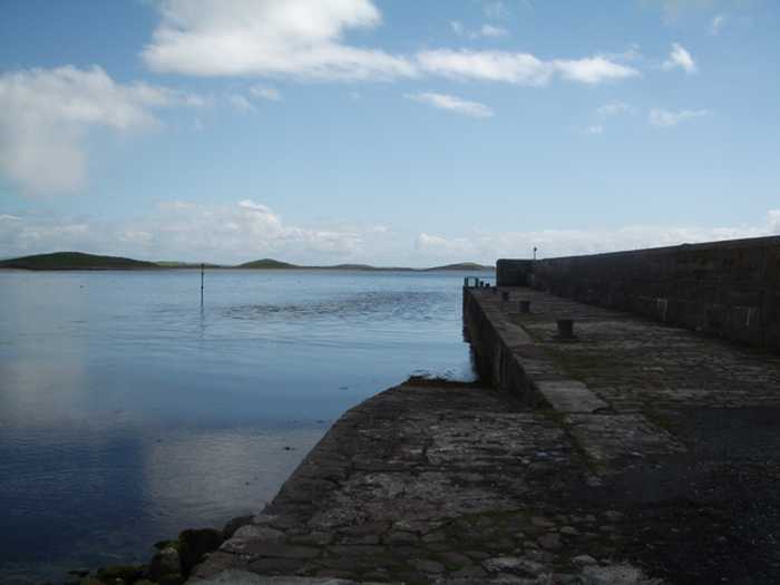
Clare Island Beach stretches from the old pier on the south to the stony shoreline on the north by the Community Centre, with submerged rocks in the northern end. Its proximity to the main harbour results in nearby homes and businesses. The sea cliffs of the northwest, north, west, and south coastline are in Clare Island Cliffs cSAC and pNHA (Site Code 002243). Clare Island also has numerous historical sites to explore. Activities such as swimming, sailing, canoeing, scuba-diving/snorkelling, and fishing are popular.
Dooega Beach, a small crescent shaped cove, is mostly sheltered except towards the south where large swells arise at the eastern rocky outcrop. It lies between the steeply sloping hills of Knockmore (at 337m) and the Menaun Cliffs (at 464m) on either side of Camport Bay. The beach is included in the Keel Machair/Menaun Cliffs SAC (Site Code 001513) and offers activities such as surfing, fishing, and canoeing. With a designated bathing area of 0.06km2, the water depth ranges from 0.5m to 5.0m depending on the tides.
Golden Strand is a beach that features a gently sloping sand dune along its headlands. The area is diverse with habitats including a machair site and two lakes, which support rare vegetation and provide an important sanctuary for birds. The beach is part of three protected areas: Doogort Machair/Lough Doo SAC/ pNHA, Croaghaun/Slievemore SAC/pNHA and Keel Machair/Menaun Cliffs SAC/pNHA. Visitors can enjoy water sports like surfing, windsurfing, and canoeing. The designated bathing area is 0.88km wide and the water covers an area of 0.51km2 with depths ranging between 0.5m and 5.0m depending on tides.
Carrowniskey Beach is a vast sandy area with a gentle slope towards the west. This beach is vulnerable to strong currents and rip tides due to its exposed location. It is home to various environments such as sand hills, machair, lagoon-like lakes, and their connected channels. In particular, the Lagoon habitat is of utmost ecological significance. Carrowniskey Beach is part of the Lough Cahasy, Lough Baun, and Roonah Lough Special Area of Conservation (cSAC) and proposed National Heritage Area (pNHA) with Site Code 001529. The bathing space covers approximately 0.8km2 while the beach stretches approximately 1.7km. The designated bathing area's water depth ranges from 0.5m to 5.0m based on tidal movements.
Silver Strand is a small beach situated about 3 Km east of Doogort village in Achill Island, with a designated bathing area spanning 150m at its west end. The beach stretches over 500m and faces north, bordered by a road leading to Seal Caves on the west and a low headland on the east. The beach is separated from the public road by a spacious grassy area and sand dunes. The bathing area is 2.25km wide and the water covers approximately 0.78km2.
Keel Beach is a sandy beach that is open to the south and can experience strong currents and rip tides. It also features scattered shingle and rocky outcrops that can be submerged during high tide. The beach is home to a variety of plant and wildlife species due to its sand dune and machair habitats. Keel Beach is part of the Achill Head and Keel Machair/Menaun Cliffs SACs, and offers various activities such as surfing, swimming, sailing, fishing, scuba-diving / snorkelling, canoeing, water skiing, and jet skiing. Its designated bathing water has a medium and maximum depth of 0.5m and 5.0m respectively, depending on tide. The beach spans approximately 1.5km2.
Keem Beach is a sheltered sandy beach with steep gradient located in Croaghan/Slievemore and Achill Head SAC. It is home to a variety of plant, animal, and bird species and offers activities such as swimming, surfing, and fishing. The designated bathing area spans approximately 0.14km2 with medium and maximum water depths of 0.5m and 5.0m respectively, depending on tide.