Keem Beach, Achill Island
- Water temp(satellite):
- 8.8°C
- 2026-03-12
Keem Beach, Achill Island is a beach in the county of Mayo. During the bathing season, a lifeguard is on duty. There are toilets and a parking spot nearby. Dogs must be kept on a leash at all times. Enhanced accessibility for disabled persons.
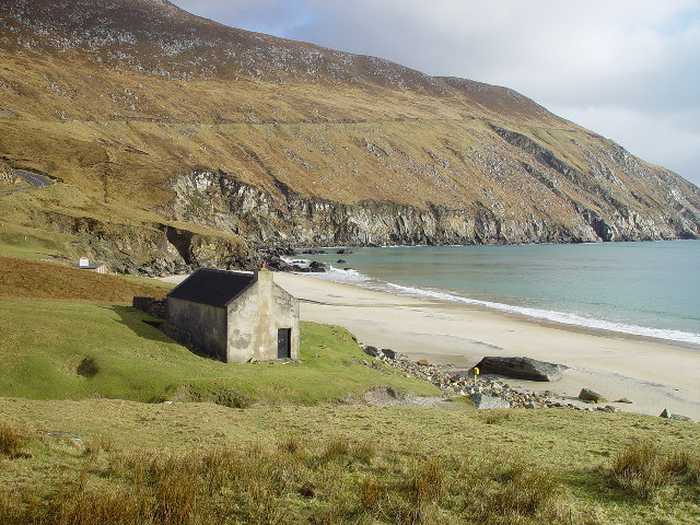
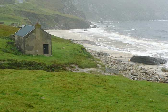
Keem Beach is a sheltered sandy beach with steep gradient located in Croaghan/Slievemore and Achill Head SAC. It is home to a variety of plant, animal, and bird species and offers activities such as swimming, surfing, and fishing. The designated bathing area spans approximately 0.14km2 with medium and maximum water depths of 0.5m and 5.0m respectively, depending on tide.
The main activities at the beach are swimming and surfing, but the beach is also used by a limited number for sailing, canoeing, water skiing, jet skies, scuba-diving / snorkeling and fishing.
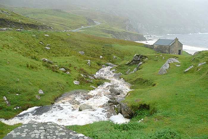
Keem beach is located approximately 10km west of Keel village on Achill Island at the end of the R319. Keem beach is a sheltered sandy horseshoe shaped beach facing southeast. It is bordered on both sides by steep cliffs, to the north by the slopes of the Croaghan Mountain and to the south by a spar called Moyteoge Head. Keem Beach forms part of Achill Head SAC (Site Code 002268) and the Croaghaun/Slievemore SAC and pNHA (Site Code 001955). The length of the Designated Beach Area (DBA) is approximately 300m and the Bathing Area is approximately 0.14km2 in area.
Keem Beach is a sheltered sandy beach facing southeast with a steep gradient. The beach has a stepped valley to the rear which is made up of boulders and stones. Two freshwater streams flow into the sea from the surrounding land at Keem beach.
Please help the next visitor by writing a few lines about the beach, are there toilets? Is it shallow? Is there a jetty or maybe a kiosk?
Beaches close to Keem Beach, Achill Island
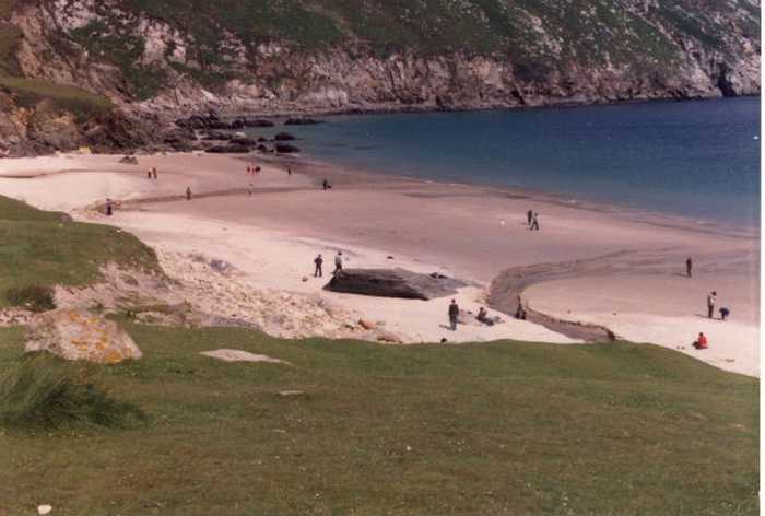
Keel Beach is a sandy beach that is open to the south and can experience strong currents and rip tides. It also features scattered shingle and rocky outcrops that can be submerged during high tide. The beach is home to a variety of plant and wildlife species due to its sand dune and machair habitats. Keel Beach is part of the Achill Head and Keel Machair/Menaun Cliffs SACs, and offers various activities such as surfing, swimming, sailing, fishing, scuba-diving / snorkelling, canoeing, water skiing, and jet skiing. Its designated bathing water has a medium and maximum depth of 0.5m and 5.0m respectively, depending on tide. The beach spans approximately 1.5km2.
Silver Strand is a small beach situated about 3 Km east of Doogort village in Achill Island, with a designated bathing area spanning 150m at its west end. The beach stretches over 500m and faces north, bordered by a road leading to Seal Caves on the west and a low headland on the east. The beach is separated from the public road by a spacious grassy area and sand dunes. The bathing area is 2.25km wide and the water covers approximately 0.78km2.
Dooega Beach, a small crescent shaped cove, is mostly sheltered except towards the south where large swells arise at the eastern rocky outcrop. It lies between the steeply sloping hills of Knockmore (at 337m) and the Menaun Cliffs (at 464m) on either side of Camport Bay. The beach is included in the Keel Machair/Menaun Cliffs SAC (Site Code 001513) and offers activities such as surfing, fishing, and canoeing. With a designated bathing area of 0.06km2, the water depth ranges from 0.5m to 5.0m depending on the tides.
Golden Strand is a beach that features a gently sloping sand dune along its headlands. The area is diverse with habitats including a machair site and two lakes, which support rare vegetation and provide an important sanctuary for birds. The beach is part of three protected areas: Doogort Machair/Lough Doo SAC/ pNHA, Croaghaun/Slievemore SAC/pNHA and Keel Machair/Menaun Cliffs SAC/pNHA. Visitors can enjoy water sports like surfing, windsurfing, and canoeing. The designated bathing area is 0.88km wide and the water covers an area of 0.51km2 with depths ranging between 0.5m and 5.0m depending on tides.
Termon Beach, situated on the East of Blacksod Mullet Peninsula and half a kilometer south of Aghleam village in Co Mayo, is a small, sheltered, and sandy beach. It has significant ecological importance serving as part of the Blacksod Bay Broadhaven Special Protection Area (SPA), the Mullet Blacksod Bay Complex candidate Special Area of Conservation (cSAC), and the Mullet Blacksod proposed National Heritage Area (pNHA).
Mullaghroe Beach, found on the Mullett Peninsula, is an exposed sandy beach with a diverse range of marine habitats, including a vast sand dune system, dune grassland, and machair, which support an array of plant and wildlife species, particularly birds and plants. The Mayo Gaeltacht's special area of conservation/proposed Natural Heritage Areas, Mullet/Blacksod Bay Complex (Site Code 000470) and Blacksod Bay/Broadhaven (Site Code 004037) SPA, cover this location, which is also a designated shellfish water and fishing spot. The bathing area spans approximately 0.870km wide, with the bathing water covering an area of about 0.32km2. Depending on the tide, the water depth can range from 0.5m to 5.0m at the designated bathing water.
Elly Bay is a sandy beach with sand dunes, dune grassland, and machair. It is home to various wildlife and plant species, particularly birds, and is classified as a Special Area of Conservation (SAC)/proposed Natural Heritage Area (pNHA) and SPA. It is also part of the Mayo Gaeltacht and Blacksod Bay Designated Shellfish Waters. The beach is primarily for swimming, with a designated area of 1.2km wide and a bathing water area of 0.42km2 with varying water depths up to 5.0m depending on the tides.
Clare Island Beach stretches from the old pier on the south to the stony shoreline on the north by the Community Centre, with submerged rocks in the northern end. Its proximity to the main harbour results in nearby homes and businesses. The sea cliffs of the northwest, north, west, and south coastline are in Clare Island Cliffs cSAC and pNHA (Site Code 002243). Clare Island also has numerous historical sites to explore. Activities such as swimming, sailing, canoeing, scuba-diving/snorkelling, and fishing are popular.
Srah Beach is a lovely sandy beach located in the northeastern part of Blacksod Bay. The beach is named after the Irish term 'Sraith', which denotes the sandy stretch that connects Claggan Island to the mainland. Srah beach is included in the Blacksod Bay/Broadhaven SPA and the Mullet/Blacksod Bay Complex SAC.
Cross Beach is a vast sandy beach situated on the west coast of Mullet Peninsula, offering stunning views of Inis Gé and Inis Glora islands. The beach is a convenient 10-minute drive from Belmullet town, and the Cross Loop Walk allows you to explore the beach and the neighboring Cross lake.