Gordon Dunn
Photo: Gordon Dunn CC BY-SA 2.0

Port, Lurganboy

Rating: 0.0/5 (0 votes)

  • Water temp(satellite):
  • 13.0°C
  • 2024-10-14

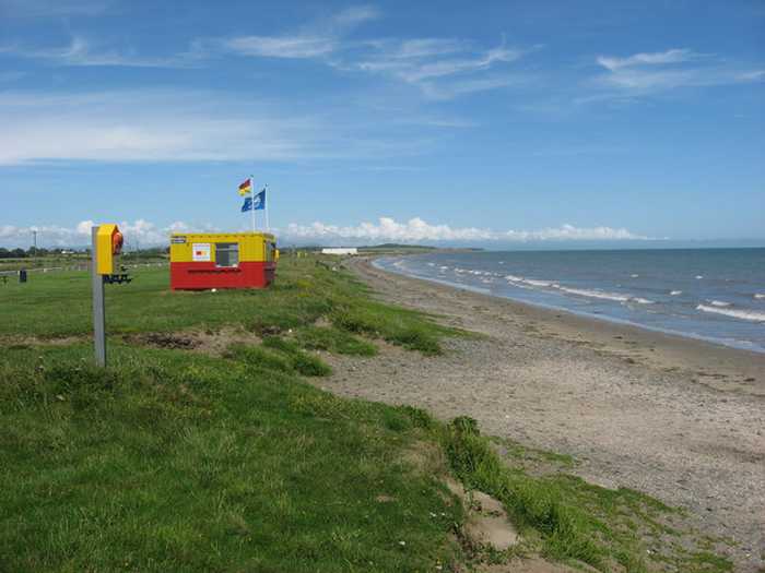
Port, Lurganboy is located in the county of Louth. During the bathing season, a lifeguard is on duty. There are restrooms and a parking space nearby. Dogs must be kept on a leash.
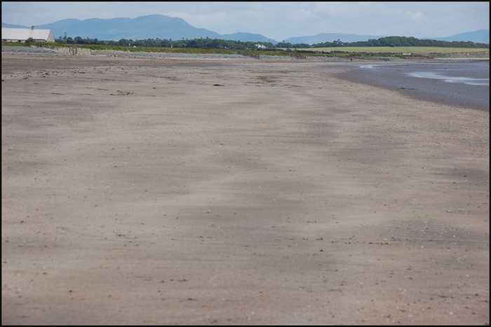
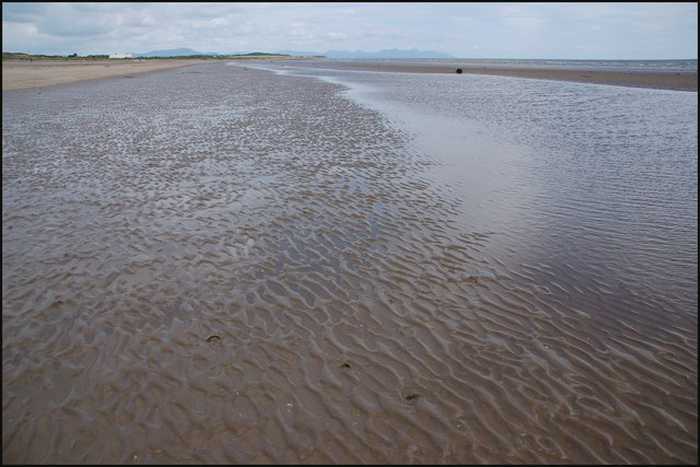
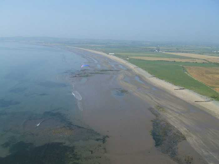
The beach is predominantly composed of sand, with a minor section of rocky formations that are interspersed with sand dunes. These dunes, in turn, provide a thriving habitat for a diversity of plant species, contributing to the ecological value of the area. Additionally, a range of fauna, such as crabs and seaweed, are present on the site. It is important to note that the contiguous conservation-designated zones in close proximity to the beach are Clogherhead SAC and Dunany Point NHA. The beach spans a length of approximately 2300 meters, and the area designated for swimming gradually descends into the ocean.
There is an amenity area comprising of a car-park, picnic area and toilet facilities. Bye laws arein existence to exclude motorized vehicles from the beach. Lifeguards are on the beach atspecified times during the bathing season. The estimate number of visitors to the beach would beapproximately 200 visitors per day.
The existing site is located along a stretch of sandy shoreline which extends from Dunany Point in the north to Clogherhead in the south. This coastal area is characterised by expanses of flat sandy beaches which grade gently into the Irish Sea. The site has been highly modified by past activities and supports little area of natural habitat. The remaining areas of natural habitat are concentrated on the area of beach front with strandline and remnant dune habitats occurring in these areas. The bathing area is in the Neagh Bann river basin district. The development site lies in its entirety outside any sites which possess a statutory designation for nature conservation. The nearest sites which have a statutory designation for conservation are Clogherhead SAC and Dunany Point NHA. The length of the bathing area is approximately 2300m in length.
The bathing water can be described as mainly sandy with small areas of rocks. The length of the bathing area is approximately 2300m in length.

Weather forecast
Port, Lurganboy on the map
Report water temp:

Photos near Port, Lurganboy

Albert Bridge
Photo: Albert Bridge CC BY-SA 2.0
Albert Bridge
Photo: Albert Bridge CC BY-SA 2.0
Kieran Campbell
Photo: Kieran Campbell CC BY-SA 2.0
Kieran Campbell
Photo: Kieran Campbell CC BY-SA 2.0
Do you have a nice picture from Port, Lurganboy?
By uploading an image, you certify that you own the image and that it may be displayed on beachguideireland.com

Reviews of Port, Lurganboy

No reviews of Port, Lurganboy yet...
Please help the next visitor by writing a few lines about the beach, are there toilets? Is it shallow? Is there a jetty or maybe a kiosk?
What do you think of the beach?

Beaches close to Port, Lurganboy

Clogherhead ⟼ 4.8 km away
Clogherhead beach is a spacious and gently sloping sandy beach located mainly to the east, with rock and dune formations to the north. Two small rip currents exist at the beach's northern end, while the area features sand dunes and rocks, as well as a variety of marine life, such as crabs, jellyfish, sea beet, and limpets. To preserve the beach, Foreshore Byelaws 2003 prohibit motorized vehicles from entering the area. During peak season, an estimated 200 visitors visits the beach daily, which has a gently sloping bating area spreading over a length of roughly 1430 meters.
Seapoint ⟼ 7.9 km away
Seapoint Beach is a spacious expanse of sand and shingle, with its bathing water situated adjacent to sand dunes. Its designated 1270m long bathing area is separated by the Termonfeckin River. Additionally, to the south, there are some small rocky sections and sand bars.
Mornington ⟼ 12.1 km away
Mornington beach is a beautiful sandy beach bordered by sand dunes, situated between the Boyne estuary and Bettystown. To preserve the dunes' conservation value, boardwalks are available for beach access. These dunes are a part of the Boyne Coast and Estuary Special Area of Conservation (SAC site code 001957), with the Boyne estuary designated as a Special Protected Area (SPA site code 004080).
Laytown/Bettystown ⟼ 14.1 km away
Laytown/Bettystown is a stunning beach with fine sand and sand dunes that is home to a links golf course. The area to the north is a Special Area of Conservation (SAC site code 001957), known as the Boyne Coast and Estuary, while the south is a designated Special Protected Area (SPA site code 004158), specifically the River Nanny Estuary and Shore. Visitors can partake in a variety of beach activities, including sandsculpting and kitesurfing, and Laytown/Bettystown has also hosted the National Sand Sculpting and Sandcastle Competition. An annual event, the Laytown Strand Race, takes place on the beach, which has a bathing area approximately 1.5 km long and 0.6 km2 in size.
Shelling Hill/Templetown ⟼ 18.6 km away
Templetown Beach is a spacious, south-facing beach, comprised of sand and shingle. The bathing water is situated in close proximity to the sandy dunes which house a range of plant species and wildlife, including limpets and crabs. The designated bathing area spans 0.2Km whilst the beach extends in both directions beyond the designated area. The beach gradually slopes into the sea.
Balbriggan, Front Strand Beach ⟼ 24.3 km away
Balbriggan Front Beach is a compact sandy beach that is adjacent to a functioning harbor.
Skerries, South Beach ⟼ 29 km away
Skerries South Beach is a lengthy sandy shore that gradually slopes towards the sea. The beach's northern edge is demarcated by the Red Island headland rocks.
Loughshinny Beach ⟼ 33.3 km away
Loughshinny Beach is a small, sheltered sandy cove that gently slopes down. It is located in close proximity to Loughshinny harbour, which is a bustling fishing hub situated to the east of the beach.
Rush North Beach ⟼ 35.3 km away
Rush North Beach is a sandy beach with a large dune area at the back, gently sloping and bordered by Rush Harbour on the South and a rocky headland on the North.
Rush, South Beach ⟼ 36.2 km away
South Beach Rush is a sandy beach with a sloping landscape and a large sandy dune area in the rear. The beach is partially sheltered by a rocky headland to the North.
Beach Guide Ireland Source for water samples and information: the Environmental Protection Agency, users of the site and local municipalities.
Source for weather data: Met Éireann© (CC BY 4.0) Disclaimer: Met Éireann does not accept any liability whatsoever for any error or omission in the data, their availability, or for any loss or damage arising from their use.
Source of satellite-read water temperature: Copernicus Sentinel satellite data from the European Space Agency.