Please help the next visitor by writing a few lines about the beach, are there toilets? Is it shallow? Is there a jetty or maybe a kiosk?
Beaches close to Ballyheigue
Banna Bathing Water is situated in a rustic environment without any buildings on the sand dune system or promenade behind it. The beach is backed by a vast sand-dune system that stretches from Ballyheigue to Barrow, with minimal vegetation growing in the water. The area is within the Akeragh, Banna, and Barrow Harbour Special Protection Area and Special Area of Conservation. The activities allowed include walking and swimming, and the width of the bathing area is around 445 meters.
Fenit Beach is a south-facing, sheltered sandy beach with a concrete promenade along its length. Vegetation is scarce on this beach, and there isn't any significant vegetation in the water either. The beach is located near Tralee Bay & Magharees Peninsula Special Area of Conservation and offers activities such as walking, swimming, sailing, surfing and angling. With a width of approximately 160 meters, Fenit Beach is a perfect place to enjoy water sports and outdoor activities.
Derrymore Beach, a beautiful sandy beach perfect for walking, can be found just a few miles from Tralee in County Kerry.
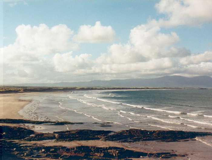
Ballybunnion South is a beach that faces west onto the Atlantic ocean, making the water rough at times. A thin strip of vegetation stands between the beach and the road that links it to Ballybunnion town. The bathing water is located in the Lower River Shannon, site code SAC 002165, and the beach is approximately 250 m wide. It offers activities such as walking, swimming, surfing, and angling.
Maharabeg Beach is a sheltered, sandy beach facing east/south-east into Tralee Bay, located on the Maharees Peninsula. Its fixed marram-dunes support a variety of vegetation, including coastal grassland. The catchment area falls within the Tralee Bay and Magharees Peninsula Special Area of Conservation. Popular activities at the beach include swimming, angling, and water sports. The bathing area, which is around 700m long, is situated on the eastern side of the peninsula.
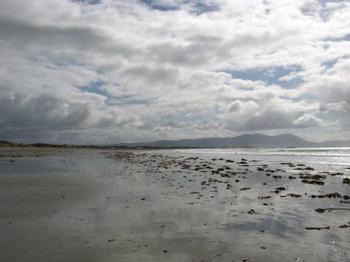
Ballybunnion North is a wide, exposed sandy beach that faces the Atlantic ocean with no notable vegetation. It has a concrete promenade along its rear, making it prone to rough conditions. The beach is located in Lower River Shannon (SAC 002165) and is suitable for activities such as swimming, walking, angling, and surfing. The bathing area measures approximately 250 meters in width.
Castlegregory Beach is situated in County Kerry on the northern side of the Dingle Peninsula in the South West of Ireland. Its sandy stretch faces north-east and is sheltered from harsh wave activity and south-westerly winds thanks to its orientation and location next to the Maharees Peninsula. It is a well-known destination among bathers and walkers, with public car-parking and seasonal public conveniences available in close proximity to the bathing area.
Carrigaholt Bay's western shore hosts its bathing area.
The Shannon river mouth features a sandy beach divided into 3 sections: Kylatallin to the West, Littor in the mid-section, and Currigane to the east-end.
Inch Strand is a west-facing sandy beach that overlooks Dingle Bay and the Atlantic Ocean. The beach's sand dune system houses a diverse range of plant species, with additional salt marsh and mudflat areas providing a habitat for various bird species. Inch Spit is situated within the greater Castlemaine Harbour Special Area of Conservation, and parts of Castlemaine Harbour and Dingle Bay are designated Special Protection Areas for birds and shellfish. Activities on the beach are regulated by the Kerry County Council Beach Bye-Laws, 2013. The identified bathing waters on Inch Spit comprise only 1.4km of the beach's full length of approximately 5km.