Trá Inis Oírr (Main Beach)
- Water temp(satellite):
- 10.5°C
- 2025-04-23
Trá Inis Oírr (Main Beach) is located in the county of Galway. Life guard is present at bathing season, 12-6 weekends July Aug. Public toilets. Dogs are not allowed on the beach.
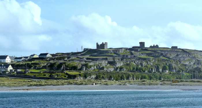
Inis Oírr, located 17km from Galway and 9km from Clare, boasts Trá Inis Oírr, a stunning beach on its northern coast. Through traditional farming methods, the island has managed to preserve its top ecological status. Additionally, Inis Oírr hosts international avian species identified under Annex 1 of the Birds Directive. The island serves as a breeding ground for Choughs, while other safeguarded birds such as Little Tern, Arctic Tern, and Sandwich Tern can also be found on this magnificent island.
The main activity is swimming but some kayaking and windsurfing takes place also. Activities prohibited are those listed in Beach Bye-Laws for the County Health District of Galway included in this profile as Appendix 1.
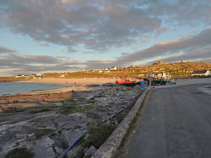
Inis Oírr is part of the Galway Coast Water Management Unit of the Western River Basin District. It is situated 17km off the Galway coast and 9km off the Clare coast. It is the smallest of the Aran Islands and has a population of about 250. The beach is on the northern coast of the island and is known as Trá Inis Oírr. Access is via the R 743 and there is no difficulty in entering onto the beach. The area of the beach is approx. 0.01km2 and the length is approx. 300m. The beach caters for up to 50 bathers during the summer season. There are a number of ways to reach the Island including by boat either directly from Galway City Dockside, Ros a Mhil (Rossaveal) in Connemara or from Doolin in County Clare. The island can also be reached by air from Connemara Airport in Indreabhan (Inverin). This beach has Life Guards at weekends. Information on the local area is on board at beach.
Please help the next visitor by writing a few lines about the beach, are there toilets? Is it shallow? Is there a jetty or maybe a kiosk?
Beaches close to Trá Inis Oírr (Main Beach)
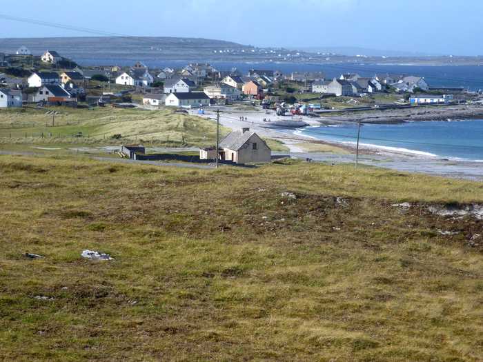
This serene sandy beach is situated on the north-eastern shore of Inis Oirr in outer Galway Bay. It's a favourite spot among locals and can be reached via a tar road. Fishermen frequent the beach and it's conveniently located near the airstrip and lighthouse. It's just a 15-minute walk from the pier, offering breathtaking views of the Clare coastline and the picturesque countryside.
Fanore Beach is a beautiful sandy area with exposed limestone at low tide. It boasts a dune area in the northeast with diverse plant life. Surfing and wind surfing are popular activities, but the use of motorised watercraft, canoes and kayaks are not allowed near swimmers. Horse riding and dogs are prohibited between 11am and 6pm during the summer season, as per beach bye-laws.
Cill Mhuirbhigh beach is a sandy, sheltered shore with rocky boundaries to the west and east. There's also a small area of marram dune with a diverse vegetation range. The Machair habitat within Cill Mhuirbhigh hosts various rare plant species and supports animal and bird communities containing endangered species. The plants are protected by law, and their rarity has earned them a place in the Irish Red Data Book. The prehistoric fort Dún Aonghusa, a UNESCO World Heritage Site, is located on the island, which has immense cultural and environmental significance.
Lahinch is a sandy beach with strong waves and currents, protected by a rocky barrier to prevent erosion. The bathing area is free of vegetation and popular activities include surfing, kite surfing, wind surfing, horse riding, and angling. Personal watercraft and fast power craft are not allowed. During the summer, beach bye-laws prohibit horse riding and dogs between 11am and 6pm.
Trá na Reilige is a small sandy beach, about 50m long, situated 2km from An Cheathrú Rua village. The road leading to the beach is narrow and parking is limited, but the rugged coastline and stunning views of Ros a Mhil peninsula make it a beautiful spot to visit.
Trá an Dóilín is a unique Irish beach made up of fragments of "maerl", a calcareous seaweed. It is a rare site to find this type of material on a beach. The beach is exposed and can experience powerful waves. Along with the beach, there are various habitats including rock pools, reefs, rocky outcrops, and a freshwater lagoon that are home to a diverse range of plant, animal, and bird species. As a result, it is a popular location for snorkeling and diving.
Trá Mór is a picturesque sandy beach situated amidst rocky coasts and farmland along the Connemara coastline. This lively spot is home to diverse vegetation, fauna, and aquatic life such as seals and otters. The beach is ideal for water sports, swimming, and bathing.
White Strand is a small, sandy beach located in a narrow bay surrounded by rock formations. The presence of offshore reefs reduces wave action at the shoreline. The beach is home to various marine wildlife, vegetation, fish, and shellfish. Swimmers are protected from motorized watercraft, surfing, canoes, and kayaks. Seasonal beach bye-laws prohibit horse riding and dogs from 11 am to 6 pm.
Trá Mór is a sheltered sandy beach facing east, situated on Garumna island in south Conamara between Carraveg and Greatman's bays. The rocky shoreline has several small cove-like beaches along its length. The beach is around 7 km south of Beál an Daingin and accessible via the L52323-0 local road. It falls within the Kilkieran Bay and islands protected area.
Céibh an Spidéil is an east-facing sandy cove that features a fishing pier and rocky shore. It offers diverse plant and animal life, including otters and seals. Swimming and fishing are popular activities.