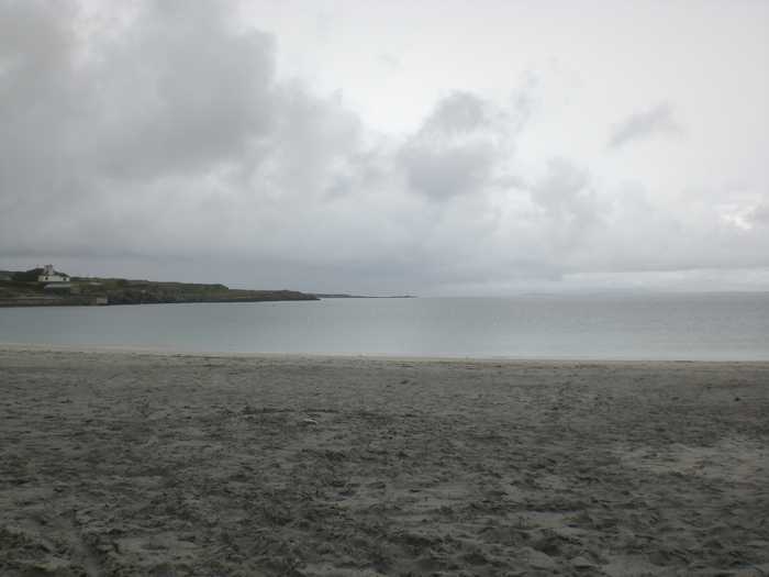
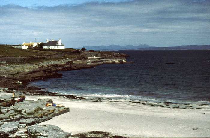
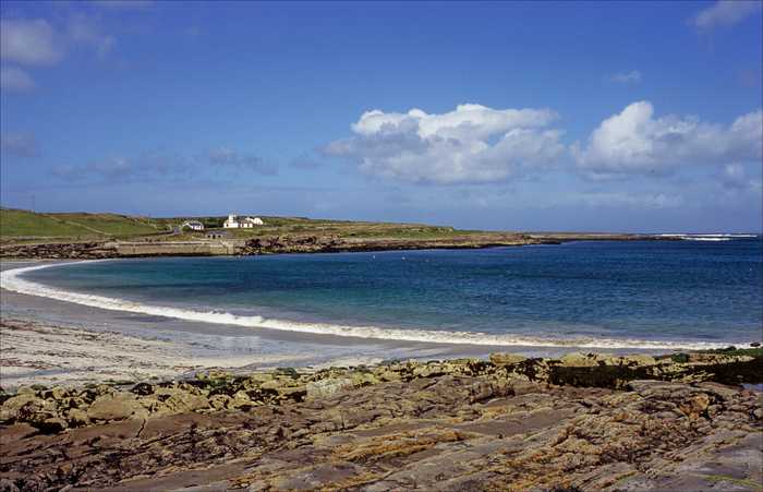
Cill Mhuirbhigh, Inis Mór
- Water temp(satellite):
- 10.4°C
- 2025-04-23
Cill Mhuirbhigh, Inis Mór is located in the county of Galway. During bathing season, a lifeguard is on duty, 12-6 7 days July & Aug weekend June/Sept. Toilets and parking lot near the beach. Dogs must be kept on a leash.
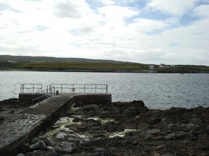
Cill Mhuirbhigh beach is a sandy, sheltered shore with rocky boundaries to the west and east. There's also a small area of marram dune with a diverse vegetation range. The Machair habitat within Cill Mhuirbhigh hosts various rare plant species and supports animal and bird communities containing endangered species. The plants are protected by law, and their rarity has earned them a place in the Irish Red Data Book. The prehistoric fort Dún Aonghusa, a UNESCO World Heritage Site, is located on the island, which has immense cultural and environmental significance.
Activities prohibited are those listed in Beach Bye-Laws for the County Health District of Galway
Cill Mhuirbhigh (Kilmurvey) is a sandy blue flag beach situated on Inis Mór, the largest of the Aran Islands. It is located approximately 5km from Cill Rónáin (Kilronan) Village. Inis Mór is located at the most of westerly point of Galway Bay between the coasts of Galway and Clare. There are a number of ways to reach the Island including by boat either directly from Galway City, Ros a Mhil (Rossaveal) in Connemara or from Doolin in Co. Clare. The island can also be reached by air from Connemara Airport in Indreabhan (Inverin).
: Cill Mhuirbhigh beach is a sheltered sandy shore with rocky shore at both the western and eastern end.
Please help the next visitor by writing a few lines about the beach, are there toilets? Is it shallow? Is there a jetty or maybe a kiosk?
Beaches close to Cill Mhuirbhigh, Inis Mór
Trá an Dóilín is a unique Irish beach made up of fragments of "maerl", a calcareous seaweed. It is a rare site to find this type of material on a beach. The beach is exposed and can experience powerful waves. Along with the beach, there are various habitats including rock pools, reefs, rocky outcrops, and a freshwater lagoon that are home to a diverse range of plant, animal, and bird species. As a result, it is a popular location for snorkeling and diving.
Trá Mór is a sheltered sandy beach facing east, situated on Garumna island in south Conamara between Carraveg and Greatman's bays. The rocky shoreline has several small cove-like beaches along its length. The beach is around 7 km south of Beál an Daingin and accessible via the L52323-0 local road. It falls within the Kilkieran Bay and islands protected area.
Inis Oírr, located 17km from Galway and 9km from Clare, boasts Trá Inis Oírr, a stunning beach on its northern coast. Through traditional farming methods, the island has managed to preserve its top ecological status. Additionally, Inis Oírr hosts international avian species identified under Annex 1 of the Birds Directive. The island serves as a breeding ground for Choughs, while other safeguarded birds such as Little Tern, Arctic Tern, and Sandwich Tern can also be found on this magnificent island.
Trá na Reilige is a small sandy beach, about 50m long, situated 2km from An Cheathrú Rua village. The road leading to the beach is narrow and parking is limited, but the rugged coastline and stunning views of Ros a Mhil peninsula make it a beautiful spot to visit.
This serene sandy beach is situated on the north-eastern shore of Inis Oirr in outer Galway Bay. It's a favourite spot among locals and can be reached via a tar road. Fishermen frequent the beach and it's conveniently located near the airstrip and lighthouse. It's just a 15-minute walk from the pier, offering breathtaking views of the Clare coastline and the picturesque countryside.
Trá Chaladh Fínis is a charming rural beach that offers stunning views of Finish Island. It features diverse vegetation and presents an array of bird species. Additionally, you may spot some aquatic animals, such as seals and otters, near the shore. Popular activities at the 400-meter-long beach include swimming, bathing, and surfing.
Trá Mór is a picturesque sandy beach situated amidst rocky coasts and farmland along the Connemara coastline. This lively spot is home to diverse vegetation, fauna, and aquatic life such as seals and otters. The beach is ideal for water sports, swimming, and bathing.
Goirtín beach, located on the shores of Gurteen Bay, boasts a beautiful sandy shore and is known for its role in the acclaimed Irish film Into the West. The beach is home to a unique machair habitat, which supports several rare plant species. In addition, Goirtín is home to diverse marine life including birds, shellfish, and other plant species.
Fanore Beach is a beautiful sandy area with exposed limestone at low tide. It boasts a dune area in the northeast with diverse plant life. Surfing and wind surfing are popular activities, but the use of motorised watercraft, canoes and kayaks are not allowed near swimmers. Horse riding and dogs are prohibited between 11am and 6pm during the summer season, as per beach bye-laws.
Dog's Bay in Co Galway is a popular destination for summer holidaymakers due to its naturally protected horseshoe-shaped stretch of white sandy beach, which is over a mile long. It is located near Roundstone village and boasts of rare and interesting ecological, geological, and archaeological features. The sand at Dog's Bay is unique as it was formed from the shells of tiny sea creatures called foraminifera, and the grasslands here are considered rare, comprising of machair vegetation and found only on the west coast of Ireland and Scotland.