jai
Photo: jai CC BY-SA 2.0

Skerries, South Beach

Rating: 0.0/5 (0 votes)

  • Water temp(satellite):
  • 13.0°C
  • 2024-10-14

Skerries, South Beach is located in the county of Dublin. During the bathing season, a lifeguard is on duty, 11am to 7pm weekends only in June & full time July & August. There are toilets and a parking spot nearby. Dogs must be kept on a leash. The beach is accessible to guests with disabilities. Beach wheelchair is available. The wheelchair in Skerries is available at the Lifeguard Huts. The chair is a DeBug Chair which is designed for ease of movement on uneven ground and soft sand. The service is FREE OF CHARGE but you are strongly advised to book in advance to avoid disappointment (contact number is 086-8090153). You will be asked to complete a booking form and to present a valid ID as proof of identity.Bus Route
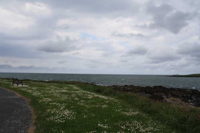
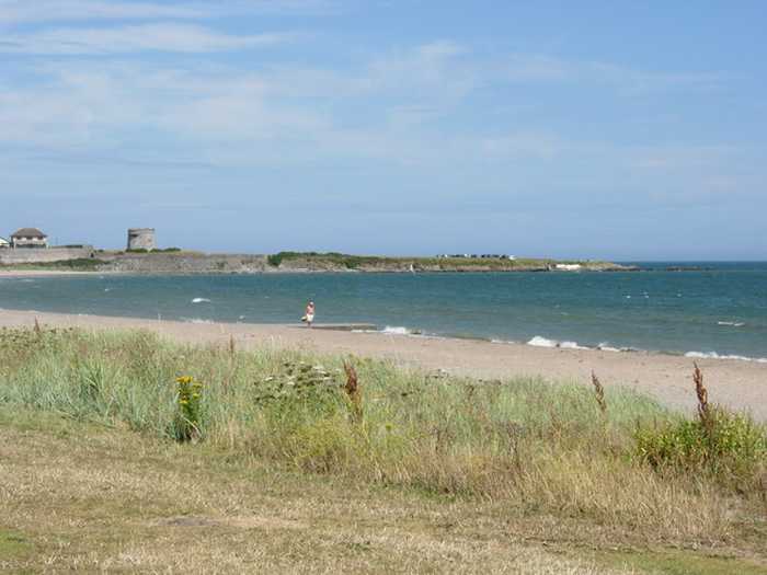
Skerries South Beach is a lengthy sandy shore that gradually slopes towards the sea. The beach's northern edge is demarcated by the Red Island headland rocks.
Swimming – Windsurfing– Sailing– Canoeing– Scuba-diving & snorkelling– Kite surfing– Fishing only in the harbour near byThere is a beautiful esplanade and coastal walkway adjacent to the beach, which ends at the Red Island
Skerries South Beach is located in Skerries town, situated in Fingal, North County Dublin. The beach is approx. 32 km from Dublin City Centre. The beach is situated to the south of RedIslandand is opposite RockabillI Island the Rockabill Lighthouse. Skerries South Beach is 2.5km long. The designated bathing area is 0.5 km long and approximately 0.04 km2. The Mill Stream discharges directly to the beach to the south of the designated bathing water.

Weather forecast
Skerries, South Beach on the map
Report water temp:

Photos near Skerries, South Beach

Cqui
Photo: Cqui CC BY-SA 3.0
Geyo John
Photo: Geyo John CC BY-SA 3.0
andrew mcmillan
Photo: andrew mcmillan CC BY 3.0
Do you have a nice picture from Skerries, South Beach?
By uploading an image, you certify that you own the image and that it may be displayed on beachguideireland.com

Reviews of Skerries, South Beach

No reviews of Skerries, South Beach yet...
Please help the next visitor by writing a few lines about the beach, are there toilets? Is it shallow? Is there a jetty or maybe a kiosk?
What do you think of the beach?

Beaches close to Skerries, South Beach

Loughshinny Beach ⟼ 4.3 km away
Loughshinny Beach is a small, sheltered sandy cove that gently slopes down. It is located in close proximity to Loughshinny harbour, which is a bustling fishing hub situated to the east of the beach.
Balbriggan, Front Strand Beach ⟼ 6.2 km away
Balbriggan Front Beach is a compact sandy beach that is adjacent to a functioning harbor.
Rush North Beach ⟼ 6.4 km away
Rush North Beach is a sandy beach with a large dune area at the back, gently sloping and bordered by Rush Harbour on the South and a rocky headland on the North.
Rush, South Beach ⟼ 7.5 km away
South Beach Rush is a sandy beach with a sloping landscape and a large sandy dune area in the rear. The beach is partially sheltered by a rocky headland to the North.
Portrane, the Brook Beach ⟼ 9.7 km away
Portrane Brook Beach is a sandy beach on the seaward side of the Portrane Peninsula, with a gradual slope. It extends to the north, becoming Burrow Beach where sandy dunes can be found. However, strong currents are present at the northern end of the beach.
Donabate, Balcarrick Beach ⟼ 11.8 km away
Donabate Balcarrick beach is a gently sloping and spacious sandy beach that faces south-east, and is surrounded by a large sandy dune area.
Laytown/Bettystown ⟼ 15.8 km away
Laytown/Bettystown is a stunning beach with fine sand and sand dunes that is home to a links golf course. The area to the north is a Special Area of Conservation (SAC site code 001957), known as the Boyne Coast and Estuary, while the south is a designated Special Protected Area (SPA site code 004158), specifically the River Nanny Estuary and Shore. Visitors can partake in a variety of beach activities, including sandsculpting and kitesurfing, and Laytown/Bettystown has also hosted the National Sand Sculpting and Sandcastle Competition. An annual event, the Laytown Strand Race, takes place on the beach, which has a bathing area approximately 1.5 km long and 0.6 km2 in size.
Portmarnock, Velvet Strand Beach ⟼ 16.7 km away
Velvet Strand Beach is an east-facing, gently sloping beach with a long, open stretch. Behind the beach are dunes.
Mornington ⟼ 17.7 km away
Mornington beach is a beautiful sandy beach bordered by sand dunes, situated between the Boyne estuary and Bettystown. To preserve the dunes' conservation value, boardwalks are available for beach access. These dunes are a part of the Boyne Coast and Estuary Special Area of Conservation (SAC site code 001957), with the Boyne estuary designated as a Special Protected Area (SPA site code 004080).
Sutton, Burrow Beach ⟼ 21 km away
Burrow Beach is a north-facing, gentle-sloping sandy beach located near Baldoyle Estuary, which is a significant wildlife habitat.
Beach Guide Ireland Source for water samples and information: the Environmental Protection Agency, users of the site and local municipalities.
Source for weather data: Met Éireann© (CC BY 4.0) Disclaimer: Met Éireann does not accept any liability whatsoever for any error or omission in the data, their availability, or for any loss or damage arising from their use.
Source of satellite-read water temperature: Copernicus Sentinel satellite data from the European Space Agency.