Kay Atherton
Photo: Kay Atherton CC BY-SA 2.0

Stroove

Rating: 0.0/5 (0 votes)

  • Water temp(satellite):
  • 13.0°C
  • 2024-10-14

Stroove is a beach in Donegal. During the bathing season, a lifeguard is on duty. Near the beach, there are toilets and a parking area. Dogs must be kept on a leash. The beach is accessible to guests with disabilities.
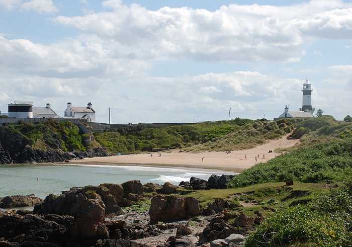
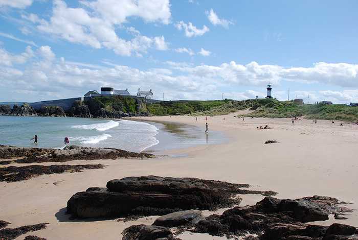
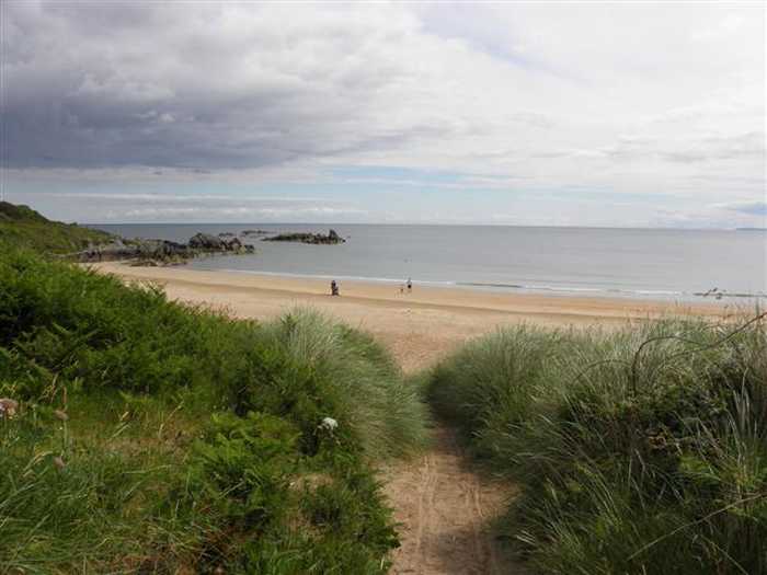
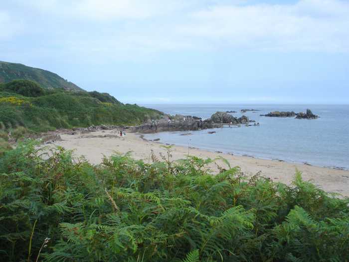
Stroove Beach is a small sandy beach with rocky headlands to the east and west. The tidal phase during the day exposes the beach. The beach offers an excellent variety of coastal habitats, including high rocky cliffs, offshore islands, sand dunes, salt marsh, large intertidal bay, and rocky, shingle, and sand beaches. Due to its extensive area of unspoilt coastal habitats, the site holds high conservation value. The catchment area is an ideal spot for bird watching and ecological activities. Visitors can enjoy swimming and land-based activities like football. The designated bathing area covers 0.01534km2, extending to approximately 160m along the water. The water gets deeper within 2 meters off the shore.
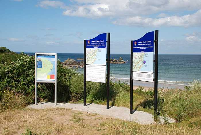
Facilities: Facilities available at the beach include car parking, freshwater tap in car park, toilets (seasonal), information boards including water quality data and lifeguards (seasonal – dates and times can be found on the information boards). During the lifeguarded periods, extra facilities provided by the lifeguards include: emergency information, telephone access, first aid equipment and rescue equipment. There has been a no bin system (pack it in, pack it out) in place at this beach since 2010. There are shops, restaurants etc available in the town of Moville and the village of Greencastle approximately 4km from the beach. Visitor Numbers: Visitor numbers to the beach vary throughout the season. The maximum number of visitors to the beach during a high season day has been estimated at approximately 400 people with approximately half of this number swimming. Throughout the season approximately 8,000 people have been estimated to visit the beach. Visitor numbers are representative of the visitors recorded by the lifeguards that are on duty during the bathing season. Activities: Activities at Stroove Beach include swimming, stand up paddle boarding, kayaking, fishing and other land-based activities such as football and kite flying.
Stroove (An tSrúibh) Blue Flag Beach is located close to the village of Greencastle which is on the eastern coast of the Inishowen Peninsula in County Donegal. It is located in the North Atlantic Seaboard Coastal waterbody (NW_230_0000) within the North Western River Basin District. The designated bathing area is approx. 0.01534km2 and the extent along the water is approximately is 160m.
: Stroove beach consists of a small sandy beach. The beach is exposed at times during the tidal phase during the day. The beach is contained to the east and west by rocky headlands.

Weather forecast
Stroove on the map
Report water temp:

Photos near Stroove

Patrick Mackie
Photo: Patrick Mackie CC BY-SA 2.0
Patrick Mackie 
Photo: Patrick Mackie  CC BY-SA 2.0
Patrick Mackie 
Photo: Patrick Mackie  CC BY-SA 2.0
Kenneth  Allen 
Photo: Kenneth Allen  CC BY-SA 2.0
Do you have a nice picture from Stroove?
By uploading an image, you certify that you own the image and that it may be displayed on beachguideireland.com

Reviews of Stroove

No reviews of Stroove yet...
Please help the next visitor by writing a few lines about the beach, are there toilets? Is it shallow? Is there a jetty or maybe a kiosk?
What do you think of the beach?

Beaches close to Stroove

Culdaff ⟼ 15.7 km away
Culdaff beach is a sandy beach with two rock outcrops located in the southeast. The beach is bordered by sand dunes to the west and the Culdaff River to the northwest, offering ample opportunities for ecological exploration and bird watching due to its unspoiled coastal habitats that are home to various plant and animal species. The beach is perfect for water-based activities such as swimming, kayaking, boating, windsurfing, and surfing. Shore angling and land-based activities such as walking, kite flying, and rock climbing are also popular around the location.
Lady's Bay, Buncrana ⟼ 35.6 km away
Lady's Bay beach is a sandy stretch located in Lough Swilly, with Buncrana pier and a rocky outcrop serving as its boundaries. It's part of a group of beaches on the West of Inishowen, and boasts a diverse range of plant and wildlife species, such as otters, Mallard, Lady's fern and wood sage. It's also included in The Lough Swilly SAC, which is critically important for conservation and contains four habitats listed on Annex I of the EU Habitats Directive. Visitors can participate in water-based activities such as swimming, boating, power boating, and jet skiing, as well as beach activities. The designated bathing area is roughly 0.02633 km² and extends about 550m. The beach has a medium gradient leading to a medium slope, gradually getting deeper until it reaches the channel.
Lisfannon ⟼ 38 km away
Lisfannon Beach is a beautiful sandy beach located along the Swilly Estuary that offers shallow water and intertidal sand and mud flats. These habitats are home to many different plant and animal species, including otters, and are quite valuable for conservation purposes. Visitors to Lisfannon Beach can enjoy various activities, such as swimming, surfing, football, or kite flying. The bathing area is a designated spot that covers approximately 0.6217 km2, and the water depth gradually increases from 0.5 meters within 2 meters off the shore. Overall, Lisfannon Beach is a lovely destination that offers natural beauty and plenty of opportunities for outdoor fun.
Rathmullan ⟼ 40.9 km away
Rathmullan beach, located in Lough Swilly, offers a sandy stretch extending from Rathmullan pier in the South up to the Glebe outcrop in the North. The area is home to a diverse range of plant and wildlife, including otters. A visit to the Rathmullan Wood Nature Reserve offers an opportunity to explore various tree species. The beach offers a range of activities, such as swimming, kayaking, boating, sailing, power boating, diving, and other land-based activities. The designated swimming area spans roughly 0.142km2, with the waterline extending along 1380m. The beach's steep gradient leads to a water depth of about 1m approximately 10m from the water line.
Portsalon ⟼ 43.3 km away
Portsalon Beach is a sandy beach situated along the Swilly Estuary, bounded by Knockalla headland to the south and flat land to the north. The tidal phase exposes the rocks at times during the day. It is a vital habitat for numerous seabirds and wildfowl, and the nearby Horn Head to Fanad Head SPA is of high conservation value due to its unspoilt coastal habitats and wide range of plant and animal species. The catchment area is perfect for bird watching and ecological activities. Visitors can enjoy water-based activities like swimming, surfing, and wind surfing, as well as land-based activities like football and kite flying. The 0.588 km2 designated bathing area is approximately 3060 meters long, with water depth gradually increasing from 1 meter within 2 meters off the shore.
Ballyhiernan, Fanad ⟼ 49.2 km away
Ballyhiernan beach is a beautiful sandy beach located in the north with stunning sand dunes. The beach boasts three bays - Carrickachurdin Bay, Kinlackagh Bay and Trabane Bay. It's a haven for wildlife lovers as the beach is home to a diverse range of birds, and even features two notable species - the Common Frog and Irish Hare. Furthermore, the beach is perfect for adventure enthusiasts as it offers a wide range of activities, both water, and land-based such as kayaking, surfing, power boating, and more.
Beach Guide Ireland Source for water samples and information: the Environmental Protection Agency, users of the site and local municipalities.
Source for weather data: Met Éireann© (CC BY 4.0) Disclaimer: Met Éireann does not accept any liability whatsoever for any error or omission in the data, their availability, or for any loss or damage arising from their use.
Source of satellite-read water temperature: Copernicus Sentinel satellite data from the European Space Agency.