Please help the next visitor by writing a few lines about the beach, are there toilets? Is it shallow? Is there a jetty or maybe a kiosk?
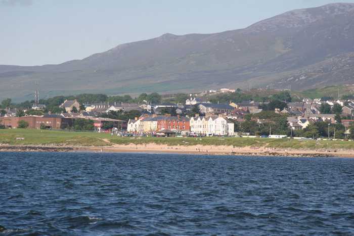
Beaches close to Lady's Bay, Buncrana
Lisfannon Beach is a beautiful sandy beach located along the Swilly Estuary that offers shallow water and intertidal sand and mud flats. These habitats are home to many different plant and animal species, including otters, and are quite valuable for conservation purposes. Visitors to Lisfannon Beach can enjoy various activities, such as swimming, surfing, football, or kite flying. The bathing area is a designated spot that covers approximately 0.6217 km2, and the water depth gradually increases from 0.5 meters within 2 meters off the shore. Overall, Lisfannon Beach is a lovely destination that offers natural beauty and plenty of opportunities for outdoor fun.
Rathmullan beach, located in Lough Swilly, offers a sandy stretch extending from Rathmullan pier in the South up to the Glebe outcrop in the North. The area is home to a diverse range of plant and wildlife, including otters. A visit to the Rathmullan Wood Nature Reserve offers an opportunity to explore various tree species. The beach offers a range of activities, such as swimming, kayaking, boating, sailing, power boating, diving, and other land-based activities. The designated swimming area spans roughly 0.142km2, with the waterline extending along 1380m. The beach's steep gradient leads to a water depth of about 1m approximately 10m from the water line.
Portsalon Beach is a sandy beach situated along the Swilly Estuary, bounded by Knockalla headland to the south and flat land to the north. The tidal phase exposes the rocks at times during the day. It is a vital habitat for numerous seabirds and wildfowl, and the nearby Horn Head to Fanad Head SPA is of high conservation value due to its unspoilt coastal habitats and wide range of plant and animal species. The catchment area is perfect for bird watching and ecological activities. Visitors can enjoy water-based activities like swimming, surfing, and wind surfing, as well as land-based activities like football and kite flying. The 0.588 km2 designated bathing area is approximately 3060 meters long, with water depth gradually increasing from 1 meter within 2 meters off the shore.
Ballyhiernan beach is a beautiful sandy beach located in the north with stunning sand dunes. The beach boasts three bays - Carrickachurdin Bay, Kinlackagh Bay and Trabane Bay. It's a haven for wildlife lovers as the beach is home to a diverse range of birds, and even features two notable species - the Common Frog and Irish Hare. Furthermore, the beach is perfect for adventure enthusiasts as it offers a wide range of activities, both water, and land-based such as kayaking, surfing, power boating, and more.
Downings beach is a sandy beach located in Sheephaven Bay, bounded by Downings pier to the west and Maslack headland to the south. At low tide, a sea cave in the Maslack headland is exposed. The surrounding Peninsula boasts diverse coastal habitats, including high rock cliffs, offshore islands, sand dunes, salt marshes, a large intertidal bay, and rocky shingle and sandy beaches, which support various wildlife and vegetation. The beach offers a range of activities such as swimming, kayaking, windsurfing, sailing, surfing, power boating, jet skiing (outside the designated area), diving, and other land-based activities. The designated bathing area covers an area of approximately 0.273km2, with a water line of approximately 687m. The beach slopes very gently, with the water depth reaching 1m about 50m away from the water line.
Culdaff beach is a sandy beach with two rock outcrops located in the southeast. The beach is bordered by sand dunes to the west and the Culdaff River to the northwest, offering ample opportunities for ecological exploration and bird watching due to its unspoiled coastal habitats that are home to various plant and animal species. The beach is perfect for water-based activities such as swimming, kayaking, boating, windsurfing, and surfing. Shore angling and land-based activities such as walking, kite flying, and rock climbing are also popular around the location.
Marble Hill beach has a sandy coastline with two rock formations towards the east, visible during certain tidal phases. Its sand dunes support an array of plant species and the beach is home to various wildlife, making it a significant part of the Sheephaven SAC. Aside from land-based activities like football and kite flying, water activities such as swimming, kayaking, boating and windsurfing can be enjoyed in its designated 0.4415km2 bathing area. The water depth increases gradually from 2 meters off the shore to greater than 2 meters along the sloping shoreline.
Portnablagh beach is a small sandy beach in Ireland, confined by Portnablagh pier and a headland. It supports wildlife including birds and shellfish, making it a part of a Special Protection Area under the E.U. Birds Directive. Due to rare species, it holds special conservation interest. The beach offers various activities like swimming, kayaking, boating, windsurfing, sailing, surfing, power boating, jet skiing, diving and land-based activities. It is located beside a small working pier and slipway, however, the water off the beach gets deep quickly, with depth reaching 1m around 10m from the water line, and continuing further out in a deep slope.
Killahoey beach is a diverse coastal site comprising of sandy beaches, mud flats, sand flats, dunes and a brackish lake. It is a proposed NHA and part of a SAC, supporting various wildlife species. The bathing area is around 0.6707km2 and 1570m in length. Water depth gradually increases from 2 meters off-shore to greater than 2 meters with the shoreline slope. Activities include swimming, kayaking, boating, windsurfing, football, horse riding, kite flying, etc.
Stroove Beach is a small sandy beach with rocky headlands to the east and west. The tidal phase during the day exposes the beach. The beach offers an excellent variety of coastal habitats, including high rocky cliffs, offshore islands, sand dunes, salt marsh, large intertidal bay, and rocky, shingle, and sand beaches. Due to its extensive area of unspoilt coastal habitats, the site holds high conservation value. The catchment area is an ideal spot for bird watching and ecological activities. Visitors can enjoy swimming and land-based activities like football. The designated bathing area covers 0.01534km2, extending to approximately 160m along the water. The water gets deeper within 2 meters off the shore.