Please help the next visitor by writing a few lines about the beach, are there toilets? Is it shallow? Is there a jetty or maybe a kiosk?
Beaches close to Carrickfinn
Portarthur Beach is a north-facing sandy beach, bounded by a rocky outcrop east of Inishmeane Island and a small estuary to the south. The area features fixed dunes that support a variety of plant life, including some rare species. Birdwatchers can enjoy observing a diverse range of birds. Visitors can engage in several water and beach activities, such as swimming, kayaking, boating, and jet skiing, with a designated bathing area covering approximately 0.225km2 of the beach. The beach has a deep gradient, with the water depth reaching 1m just 10m from the water line and continuing at a steep slope. The beach is located in a Gaeltacht area with numerous islands off the coast.
Magheraroarty is a rural area situated on the North Coast of Donegal, around 9 km away from Falcarragh town. The beach in Magheraroarty is a long sandy one, located on a strip of land with the Atlantic Ocean and Ballyness Bay on either side and Inishbofin island to the North. As it is west facing, the beach receives a strong wash of water from the rough sea, and the coastline is lined with shifting dunes, vegetated by Marram Grass. Additionally, the fixed dunes in the Magheraroarty dune ecosystem contain humid dune slacks.
Dooey is near Glenties and Dungloe on the west coast of County Donegal. The Atlantic beach is around 3km long and faces west, getting a powerful wash of water from the rough sea. The beach is sheltered to the north by a headland and bounded to the south by the Gweebarra estuary. It is situated in a rural location and backed by a remarkable sand dune system with a defined primary duneridge.
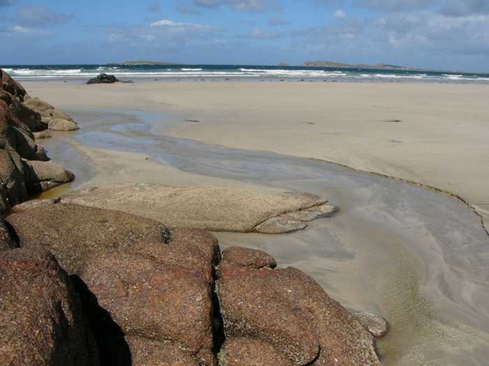
Drumnatinny beach is a north-facing sandy stretch, with Ballyness Bay to the West and Crockagarran and headlands to the East. The dunes here have several plant species and the beach has a variety of bird and animal life. Low tides expose expansive mud and sand flats in Ballyness Bay. Popular activities include swimming, kayaking, surfing, and power boating. The beach has a designated bathing area of approximately 1.317km2, sloping evenly to a depth of 1m about 10m from the water line.
Naran beach is a sheltered cove beach, located on the Atlantic coast of Ireland, spanning 2km in length. It boasts a vast sandy beach with stunning sand dunes and a diverse range of coastal and terrestrial habitats. This area has been designated a National Heritage Area and a Special Area of Conservation, making it an ideal location for bird watching and ecological activities. Visitors can enjoy various water-based activities like swimming, kayaking, boating, windsurfing, and land-based activities like football, kite flying, and walking. The designated bathing area is approximately 0.9685km2 with a shoreline length of 2120m. The water depth increases from the shoreline within 2 meters to 1 meter and gradually rises to over 2 meters.
Killahoey beach is a diverse coastal site comprising of sandy beaches, mud flats, sand flats, dunes and a brackish lake. It is a proposed NHA and part of a SAC, supporting various wildlife species. The bathing area is around 0.6707km2 and 1570m in length. Water depth gradually increases from 2 meters off-shore to greater than 2 meters with the shoreline slope. Activities include swimming, kayaking, boating, windsurfing, football, horse riding, kite flying, etc.
Portnablagh beach is a small sandy beach in Ireland, confined by Portnablagh pier and a headland. It supports wildlife including birds and shellfish, making it a part of a Special Protection Area under the E.U. Birds Directive. Due to rare species, it holds special conservation interest. The beach offers various activities like swimming, kayaking, boating, windsurfing, sailing, surfing, power boating, jet skiing, diving and land-based activities. It is located beside a small working pier and slipway, however, the water off the beach gets deep quickly, with depth reaching 1m around 10m from the water line, and continuing further out in a deep slope.
Marble Hill beach has a sandy coastline with two rock formations towards the east, visible during certain tidal phases. Its sand dunes support an array of plant species and the beach is home to various wildlife, making it a significant part of the Sheephaven SAC. Aside from land-based activities like football and kite flying, water activities such as swimming, kayaking, boating and windsurfing can be enjoyed in its designated 0.4415km2 bathing area. The water depth increases gradually from 2 meters off the shore to greater than 2 meters along the sloping shoreline.
Downings beach is a sandy beach located in Sheephaven Bay, bounded by Downings pier to the west and Maslack headland to the south. At low tide, a sea cave in the Maslack headland is exposed. The surrounding Peninsula boasts diverse coastal habitats, including high rock cliffs, offshore islands, sand dunes, salt marshes, a large intertidal bay, and rocky shingle and sandy beaches, which support various wildlife and vegetation. The beach offers a range of activities such as swimming, kayaking, windsurfing, sailing, surfing, power boating, jet skiing (outside the designated area), diving, and other land-based activities. The designated bathing area covers an area of approximately 0.273km2, with a water line of approximately 687m. The beach slopes very gently, with the water depth reaching 1m about 50m away from the water line.
Fintra Beach is a picturesque sandy beach located in a small inlet to the West of Killybegs Harbour. The beach features hills and small cliffs to the west and the estuary of the Fintragh River to the East. It is home to varied coastal habitats, including sand dunes, marine water, and low lying grass lands. Vegetated sea cliffs are the dominant feature of the site, with areas of blanket bog and dry heath also present. Visitors can enjoy a range of activities such as swimming, kayaking, boating, diving, and land-based recreational activities. The designated bathing area spans 0.2055km2 and extends approximately 670m along the water. The water depth reaches 1m roughly 20m from the waterline, with a medium gradient off the beach.