Please help the next visitor by writing a few lines about the beach, are there toilets? Is it shallow? Is there a jetty or maybe a kiosk?
Beaches close to Garryvoe
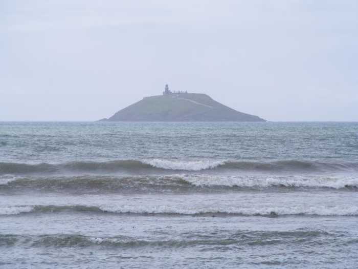
Ardnahinch Beach is situated near Shanagarry in Co Cork, offering stunning views of Ballycotton and the Island lighthouse. At low tide, the beach is expansive, but it becomes a narrow strip of sand during high tide. The beach is a part of an SPA and is a noteworthy location for bird watching. As per 'leave no trace principles,' bins are unavailable.
Ring Beach is a protected sandy beach, situated approximately 3.5 km from Ballymacoda in Co Cork. It is designated as a Special Protection Area and Special Area of Conservation. The beach faces Ballymacoda Bay and Pillmor, and no bins are provided to adhere to leave no trace principles. Visitors are encouraged to take away any waste they produce.
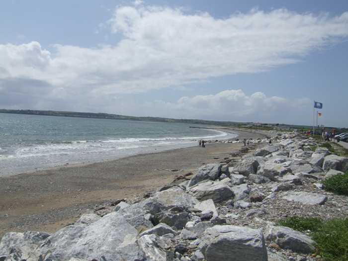
Redbarn beach is a north-facing, gently sloping shore with a mix of sand and pebble particles. It is part of a 5km long stretch of sandy coastline that is typically subject to rough weather and waves. The beach's surroundings consist of sand dunes, farmland to the northwest, Ballyvergan Marsh, a proposed Natural Heritage Area, to the north, and Ballymacoda, including Clonpriest and Pillmore, a proposed NHA and Special Area of Conservation to the south. Although Redbarn beach is not heavily trafficked, it is used by anglers, walkers, surfers, and windsurfers.
Laycastle Beach is a soft, sandy area with a small stretch of marsh and dunes, forming part of Ballyvergan Marsh (Site Code 000078) to the west. Popular activities here include surfing, windsurfing, canoeing, and angling.
Youghal Front Strand is a sandy beach with a concrete promenade area, offering surfing, windsurfing, canoeing, and angling activities. Nearby is the proposed NHA, Ballyvergan Marsh NHA (Site Code 000078).
Inch Strand is a sandy beach situated near Whitegate & Power Head, East Cork, and is a favourite spot for surfers. Visitors are reminded to follow the leave no trace principles and carry out any rubbish they create.
Whiting Bay is a 3.5 km sandy bay located west of Ardmore village.
Goats Island Beach is situated about 5km west of Ardmore in Co Waterford, with a south-facing inlet that is protected by the island to the west.
Ardmore is a gently sloped sandy beach, flanked by two special conservation areas: Helvick Head and Youghal harbour. This region supports diverse wildlife. The beach offers activities like swimming, surfing, body-boarding and kayaking. While the beach is 1 km long, the designated 500m long and 100m wide bathing area is perfect for low tide fun.
Fountainstown Beach slopes gently towards the east and consists of sand and shingle. The beach is flanked by a low rocky cliff to the north and rocky outcrops to the south. A concrete wall, along with a car park, borders the beach from the west. Fountainstown Swamp, a proposed Natural Heritage Area, is located north of the beach. The beach is primarily used for windsurfing and fishing.