Bob Jones
Photo: Bob Jones CC BY-SA 2.0

Spanish Point

Rating: 0.0/5 (0 votes)

  • Water temp(satellite):
  • 13.2°C
  • 2024-10-14

Spanish Point is a beach in Clare. During bathing season, a lifeguard is on duty. There are toilets and a parking spot nearby. Dogs must be on a leash at all times. Beach is accessible for guests with disabilities.
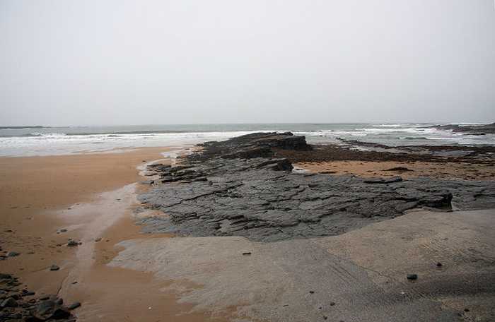
Spanish Point is a sandy beach located west of Milltown Malbay near Quilty to Lahinch road. It offers great views of the Atlantic sea at Mal Bay with a fascinating rocky shoreline and long rocks stretching into the waters. The place is home to diverse marine flora and fauna, including shellfish. Swimming and surfing are common activities while the use of motorised watercraft, surfing, canoes, and kayaks near swimmers is not allowed. A few restrictions apply, such as no horse riding or dogs allowed from 11am-6pm during summers under the beach bye-laws.
Bathing is the main activity at Spanish Point. Surfing is also very popular at this location. Clare County Council introduced Beach byelaws in May 2008 under Part 19 Local Government Act, 2001, & Local Government Act, 2001 (Commencement) Order 2006. Under these bye-laws the following activities are prohibited: • Horse riding (between 11am and 6pm) • Dog walking (between 11am and 6pm) • Any use of motorised watercraft • Surfing in the vicinity of swimmers
The bathing water at Spanish Point is located on the west coast of Clare. Spanish Point is located at Mal Bay within the Shannon Plume (Waterbody Code SH_070_0000). A small stream, Spanish Point Stream enters the designated bathing area just south of the lifeguard hut. Approximately 0.5km north of the designated bathing area another unnamed stream discharges to the sea. This waterbody has not been assigned a code or status under the Water Framework Directive. Further south of the designated bathing area the Annagh river (Waterbody name and code: SH_Annagh_AnnaghMain_1Lower (SH_28_232) discharges to Mal Bay. The designated bathing area is 36m2 approx in size and extends 200m along the shoreline.
The bathing area at Spanish Point lies to the west of Milltown Malbay on the road from Quilty to Lahinch. It is an extensive stretch of sandy beach which forms a straight face onto the open Atlantic sea at Mal Bay. Spanish Point shore can be divided into four zonation patterns. The Splash Zone which only gets wet from the splashing by waves, the Upper Zone which is only covered at high tide, the Middle Zone which is covered and uncovered for about the same length of time and the Lower Zone which is only uncovered at low tide.

Weather forecast
Spanish Point on the map
Report water temp:

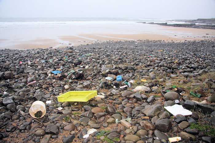
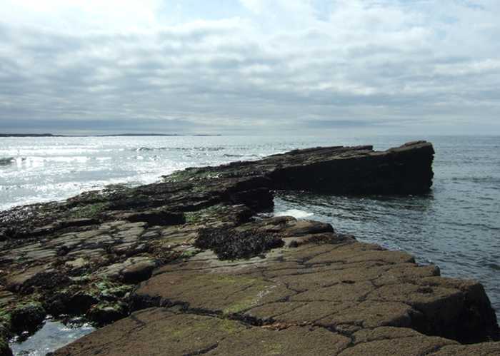
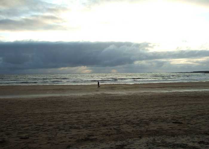
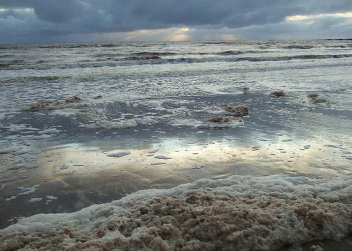
Photos near Spanish Point

Bob Jones
Photo: Bob Jones CC BY-SA 2.0
Simon Huguet
Photo: Simon Huguet CC BY-SA 2.0
Simon Huguet
Photo: Simon Huguet CC BY-SA 2.0
Simon Huguet
Photo: Simon Huguet CC BY-SA 2.0
Do you have a nice picture from Spanish Point?
By uploading an image, you certify that you own the image and that it may be displayed on beachguideireland.com

Reviews of Spanish Point

No reviews of Spanish Point yet...
Please help the next visitor by writing a few lines about the beach, are there toilets? Is it shallow? Is there a jetty or maybe a kiosk?
What do you think of the beach?

Beaches close to Spanish Point

Quilty ⟼ 2.9 km away
Quilty bathing area is in County Clare, on the southwest coast of Ireland, within the Shannon River Basin District.
White Strand, Miltown Malbay ⟼ 2.9 km away
White Strand is a small, sandy beach located in a narrow bay surrounded by rock formations. The presence of offshore reefs reduces wave action at the shoreline. The beach is home to various marine wildlife, vegetation, fish, and shellfish. Swimmers are protected from motorized watercraft, surfing, canoes, and kayaks. Seasonal beach bye-laws prohibit horse riding and dogs from 11 am to 6 pm.
Seafield, Quilty ⟼ 5.6 km away
Seafield Beach is a peaceful sandy shore situated in a rural area of County Clare. It is only 3km from Quilty village, on the south-west coast. Swimming is the primary activity at the beach, thus restrictions are enforced for motorised watercraft, surfing, canoes, and kayaks in close proximity to swimmers. Horse riding and dogs are also prohibited from 11am to 6pm during the summer season, as per beach bye-laws in place.
Lahinch ⟼ 11.6 km away
Lahinch is a sandy beach with strong waves and currents, protected by a rocky barrier to prevent erosion. The bathing area is free of vegetation and popular activities include surfing, kite surfing, wind surfing, horse riding, and angling. Personal watercraft and fast power craft are not allowed. During the summer, beach bye-laws prohibit horse riding and dogs between 11am and 6pm.
White Strand, Doonbeg ⟼ 12.9 km away
White Strand is a rural sandy beach situated on the south-west coast of County Clare. The semi-natural marine riparian zone is ideal for surfing, windsurfing, angling, and horse riding. However, motorised watercraft, surfing, canoes, and kayaks are restricted near swimmers. There are specific beach bye-laws, which prohibit horse riding and dogs between 11 am and 6 pm during the summer season.
Kilkee ⟼ 23 km away
Kilkee presents itself as a splendid crescent-shaped beach that displays brown-colored, inadequately sorted sand, and a mostly uniform altitude across its width. The predominant wave conditions in the area only allow a limited range of animal life to exist, primarily focusing on marine species. Nonetheless, the rocky shorelines flanking Kilkee offer an enticing prospect for those who aspire to explore rock pools, harboring a diverse range of wildlife. Swimming and sailing are among the several activities to engage in, while the utilization of watercraft, surfboards, canoes, and kayaks near swimmers is strictly prohibited. Furthermore, specific beach regulations exist that necessitate forbidding horse riding and dogs between 11 AM and 6 PM during the summertime.
Cappagh Pier, Kilrush ⟼ 24.1 km away
Cappagh beach, situated north of the pier, is a rocky shoreline with stones that can reach 30cm in size, limiting the presence of plants and animals. Nevertheless, the area hosts a diverse bird population and falls under the Lower River Shannon Special Area of Conservation. Cappagh beach offers activities such as swimming and bird watching, and its beach bye-laws prohibit horse riding and dog walking between 11am and 6pm during the summer season.
Trá Poll na gCaorach Inis Oirr ⟼ 24.2 km away
This serene sandy beach is situated on the north-eastern shore of Inis Oirr in outer Galway Bay. It's a favourite spot among locals and can be reached via a tar road. Fishermen frequent the beach and it's conveniently located near the airstrip and lighthouse. It's just a 15-minute walk from the pier, offering breathtaking views of the Clare coastline and the picturesque countryside.
Trá Inis Oírr (Main Beach) ⟼ 25.5 km away
Inis Oírr, located 17km from Galway and 9km from Clare, boasts Trá Inis Oírr, a stunning beach on its northern coast. Through traditional farming methods, the island has managed to preserve its top ecological status. Additionally, Inis Oírr hosts international avian species identified under Annex 1 of the Birds Directive. The island serves as a breeding ground for Choughs, while other safeguarded birds such as Little Tern, Arctic Tern, and Sandwich Tern can also be found on this magnificent island.
Ballyallia Lake, Ennis ⟼ 31.3 km away
The bathing area located at Ballyallia Lake is centered around a modest slipway and comprises small stones that span a distance of 70 meters alongside the shoreline. Notably, Ballyallia Lake is both a Special Area of Conservation and a Special Protection Area designated for the preservation of aquatic bird species and wildlife. Visitors can engage in leisurely walks and fishing activities at this location. Families with young children often frequent this area to feed ducks and enjoy picnics. To ensure safe and proper conduct, specific beach bye-laws are enforced, which includes strict regulations that prohibit horse riding and dogs during the summer season between the hours of 11 am to 6 pm.
Beach Guide Ireland Source for water samples and information: the Environmental Protection Agency, users of the site and local municipalities.
Source for weather data: Met Éireann© (CC BY 4.0) Disclaimer: Met Éireann does not accept any liability whatsoever for any error or omission in the data, their availability, or for any loss or damage arising from their use.
Source of satellite-read water temperature: Copernicus Sentinel satellite data from the European Space Agency.