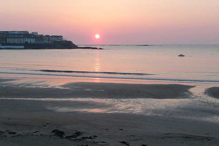
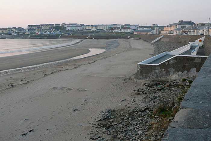
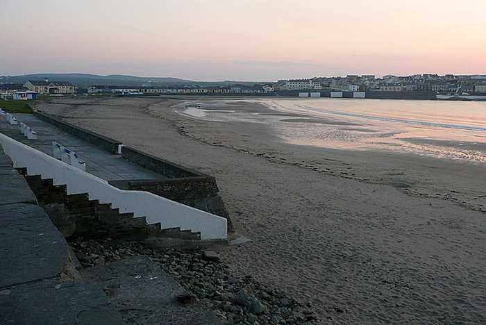
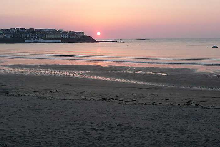
Warren Buckley
Photo: Warren Buckley CC BY-SA 2.0

Kilkee

Rating: 0.0/5 (0 votes)

  • Water temp(satellite):
  • 13.5°C
  • 2024-10-14

Kilkee is in the county of Clare. Life guard is present at bathing season. Toilets and parking lot near the beach. Dogs on lead allowed. Guests with impairments can access the beach. Beach wheelchair is available. Specially adapted beach Hippocampe chairs are available at Waterworld, Kilkee.The chairs, with specially-designed wheels, are free of charge and available seven days a week but must be booked in advance. Users will require a carer or personal assistance to operate them. Available through July and August 11am to 5:30pm. To make a booking please call Kilkee Waterworld 065-9056855
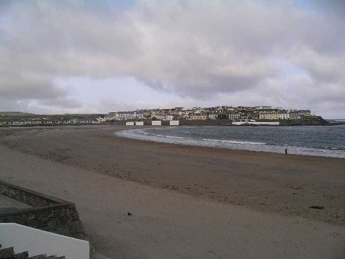
Kilkee presents itself as a splendid crescent-shaped beach that displays brown-colored, inadequately sorted sand, and a mostly uniform altitude across its width. The predominant wave conditions in the area only allow a limited range of animal life to exist, primarily focusing on marine species. Nonetheless, the rocky shorelines flanking Kilkee offer an enticing prospect for those who aspire to explore rock pools, harboring a diverse range of wildlife. Swimming and sailing are among the several activities to engage in, while the utilization of watercraft, surfboards, canoes, and kayaks near swimmers is strictly prohibited. Furthermore, specific beach regulations exist that necessitate forbidding horse riding and dogs between 11 AM and 6 PM during the summertime.
Bathing is the main activity at Kilkee. Small boats can be found docked in the bay. Clare County Council introduced Beach byelaws in May 2008 under Part 19 Local Government Act, 2001, & Local Government Act, 2001 (Commencement) Order 2006. Under these bye-laws the following activities are prohibited. Horse riding (between 11am and 6pm)Dog walking (between 11am and 6pm)Any use of motorised watercraft . Surfing in the vicinity of swimmers
The bathing water at Kilkee is located on the south-west coast of Clare. The designated bathing area is 0.1 km2 approx in size and extends 300m along a crescent shaped shoreline below the promenade at Kilkee.
The bathing area at Kilkee is a crescent shaped beach of brown coloured, poorly sorted sand and it is fairly flat over most of its width. The beach shelves gradually seawards and there are no rocks to interfere with the swimmer. The waterline extends for approximately 900m. Kilkee shore can be divided into four zonation patterns. The Splash Zone which only gets wet from the splashing by waves, the Upper Zone which is only covered at high tide, the Middle Zone which is covered and uncovered for about the same length of time and the Lower Zone which is only uncovered at low tide. The tides at Kilkee can be greatly affected by the prevailing wind and wave conditions off the coast. During windy periods and when there is a big swell, the tides can be somewhat higher than would normally be predicted.

Weather forecast
Kilkee on the map
Report water temp:

Photos near Kilkee

Graham Horn 
Photo: Graham Horn  CC BY-SA 2.0
Graham Horn 
Photo: Graham Horn  CC BY-SA 2.0
Graham Horn 
Photo: Graham Horn  CC BY-SA 2.0
Graham Horn 
Photo: Graham Horn  CC BY-SA 2.0
Do you have a nice picture from Kilkee?
By uploading an image, you certify that you own the image and that it may be displayed on beachguideireland.com

Reviews of Kilkee

No reviews of Kilkee yet...
Please help the next visitor by writing a few lines about the beach, are there toilets? Is it shallow? Is there a jetty or maybe a kiosk?
What do you think of the beach?

Beaches close to Kilkee

Carrigaholt ⟼ 8.9 km away
Carrigaholt Bay's western shore hosts its bathing area.
White Strand, Doonbeg ⟼ 10.1 km away
White Strand is a rural sandy beach situated on the south-west coast of County Clare. The semi-natural marine riparian zone is ideal for surfing, windsurfing, angling, and horse riding. However, motorised watercraft, surfing, canoes, and kayaks are restricted near swimmers. There are specific beach bye-laws, which prohibit horse riding and dogs between 11 am and 6 pm during the summer season.
Cappagh Pier, Kilrush ⟼ 11.7 km away
Cappagh beach, situated north of the pier, is a rocky shoreline with stones that can reach 30cm in size, limiting the presence of plants and animals. Nevertheless, the area hosts a diverse bird population and falls under the Lower River Shannon Special Area of Conservation. Cappagh beach offers activities such as swimming and bird watching, and its beach bye-laws prohibit horse riding and dog walking between 11am and 6pm during the summer season.
Littor beach ⟼ 12.7 km away
The Shannon river mouth features a sandy beach divided into 3 sections: Kylatallin to the West, Littor in the mid-section, and Currigane to the east-end.
Seafield, Quilty ⟼ 17.5 km away
Seafield Beach is a peaceful sandy shore situated in a rural area of County Clare. It is only 3km from Quilty village, on the south-west coast. Swimming is the primary activity at the beach, thus restrictions are enforced for motorised watercraft, surfing, canoes, and kayaks in close proximity to swimmers. Horse riding and dogs are also prohibited from 11am to 6pm during the summer season, as per beach bye-laws in place.
Ballybunnion North ⟼ 18.7 km away
Ballybunnion North is a wide, exposed sandy beach that faces the Atlantic ocean with no notable vegetation. It has a concrete promenade along its rear, making it prone to rough conditions. The beach is located in Lower River Shannon (SAC 002165) and is suitable for activities such as swimming, walking, angling, and surfing. The bathing area measures approximately 250 meters in width.
Ballybunnion South ⟼ 19 km away
Ballybunnion South is a beach that faces west onto the Atlantic ocean, making the water rough at times. A thin strip of vegetation stands between the beach and the road that links it to Ballybunnion town. The bathing water is located in the Lower River Shannon, site code SAC 002165, and the beach is approximately 250 m wide. It offers activities such as walking, swimming, surfing, and angling.
Quilty ⟼ 20.2 km away
Quilty bathing area is in County Clare, on the southwest coast of Ireland, within the Shannon River Basin District.
Spanish Point ⟼ 23 km away
Spanish Point is a sandy beach located west of Milltown Malbay near Quilty to Lahinch road. It offers great views of the Atlantic sea at Mal Bay with a fascinating rocky shoreline and long rocks stretching into the waters. The place is home to diverse marine flora and fauna, including shellfish. Swimming and surfing are common activities while the use of motorised watercraft, surfing, canoes, and kayaks near swimmers is not allowed. A few restrictions apply, such as no horse riding or dogs allowed from 11am-6pm during summers under the beach bye-laws.
White Strand, Miltown Malbay ⟼ 25.6 km away
White Strand is a small, sandy beach located in a narrow bay surrounded by rock formations. The presence of offshore reefs reduces wave action at the shoreline. The beach is home to various marine wildlife, vegetation, fish, and shellfish. Swimmers are protected from motorized watercraft, surfing, canoes, and kayaks. Seasonal beach bye-laws prohibit horse riding and dogs from 11 am to 6 pm.
Beach Guide Ireland Source for water samples and information: the Environmental Protection Agency, users of the site and local municipalities.
Source for weather data: Met Éireann© (CC BY 4.0) Disclaimer: Met Éireann does not accept any liability whatsoever for any error or omission in the data, their availability, or for any loss or damage arising from their use.
Source of satellite-read water temperature: Copernicus Sentinel satellite data from the European Space Agency.