River Barrow Bagenalstown
River Barrow Bagenalstown is a beach in Carlow. During the bathing season, a lifeguard is on duty. There are parking opportunities close to the beach. Dogs must be on a leash at all times. The beach is accessible to guests with disabilities. Train and Bus services to Bagenalstown. Drop off point 500m from bathing area.
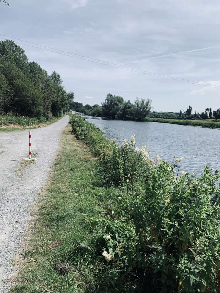
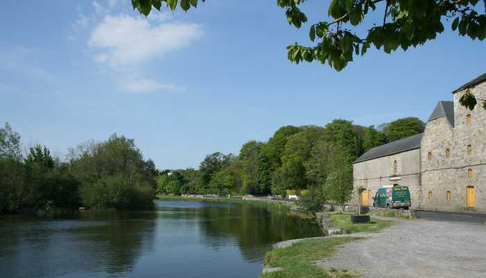
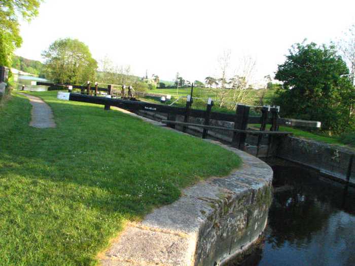
River swimming spot at Bagenalstown accessible from the riverside track. The River Barrow, which is a navigation river with weirs and lock gates at several points, offers direct access to the swimming area from a nearby car park/picnic spot. This location, widely popular with river water swimmers and triathletes, is an outstanding open water swimming site.
Please help the next visitor by writing a few lines about the beach, are there toilets? Is it shallow? Is there a jetty or maybe a kiosk?
Beaches close to River Barrow Bagenalstown
The River Barrow, which is a navigation river with weirs and lock gates, has a river bathing area that can be accessed from the riverside track. Clashganny weir and lock offer swimming opportunities both above and below the weir.
Courtown North beach is an urban fine-sand beach with gentle slopes and backed by well-vegetated dunes. The beach has a viewing area and a designated spot for jet skis. It is also used by a limited number of surfers, windsurfers, and canoeists. The bathing area spans 0.5 km in length and covers approximately 0.1 km². There is no significant vegetation growing in the waters off the beach.
Ballinesker is a serene rural beach with fine soft sand and a gentle slope. Wooden walkways may be covered with sand due to the wind. The beach is protected by sand-banks and sand dunes extend up to 70m behind the beach. However, there is no significant vegetation growth in the waters near the beach. It's popular for fishing and used by few surfers, windsurfers, and canoeists. The bathing area spans around 1 km with an area of 0.2 km².
Morriscastle beach is a serene and rural sandy beach with soft, wind-blown sand and a gentle slope. Behind the beach, the sand dunes stretch up to 100m westward. The bathing area, which spans 1.0 km in length and 0.2km² in area, falls within the conservation region of Kilmuckridge-Tinaberna sand hills, which supports unique dune habitats and thus designates Morriscastle beach as an SAC. There is no significant vegetation in the water near the beach.
Curracloe is a serene, rural beach with fine, soft, wind-blown sand and gentle slopes. It features wooden walkways that sometimes get covered by sand. Its sand dunes extend between 100m to 300m westward, while also being part of The Raven Special Protection Area that's crucial for bird conservation and is included in the Wexford Slobs and Harbour complex. It's a popular fishing spot and is sometimes used by a small number of surfers, windsurfers, and canoeists. The bathing area extends about 1 km in length and covers 0.2km².
Culleton's Gap is situated one mile from Curracloe Co Wexford, forming part of the sandy Curracloe stretch overlooking Wexford Bay and the Irish Sea towards the east. It shares borders with Raven Nature Reserve, the North Slob Land and Wild Fowl Reserve towards the west.
Rosslare Strand is an urban beach with fine, soft, windblown sand and a gentle slope. The sand dunes to the west are narrow and vegetation is scarce in the waters. The Wexford Wildfowl Reserve is located nearby, offering stunning views of the southeast coast of Ireland. The beach is a popular fishing spot, as well as a limited area for surfing, windsurfing, and canoeing. The bathing area spans 0.5 km and covers 0.1 km².